1
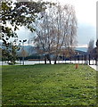
Houses at Matson
Houses at Matson with Robins Wood Hill in the background.
Image: © Philip Halling
Taken: 2 Jan 2011
0.01 miles
2
Corner of Sneedhams Road and Bazeley Road, Gloucester
Sneedhams Road houses are on the right.
Image: © Jaggery
Taken: 22 Nov 2013
0.02 miles
3
Southern end of Bazeley Road, Gloucester
Looking north from the corner of Sneedhams Road.
Image: © Jaggery
Taken: 22 Nov 2013
0.02 miles
4
Sheep road sign, Matson, Gloucester
Located at the southern end of Matson Lane, on the corner of Sneedhams Road.
Dozens of sheep graze on the nearby green.
Image: © Jaggery
Taken: 22 Nov 2013
0.03 miles
5
Sneedhams Road, Gloucester
On the left are a few of the dozens of sheep grazing http://www.geograph.org.uk/photo/3980201 on Sneedham's Green.
The right turn is for Caledonian Road. http://www.geograph.org.uk/photo/3980198
Image: © Jaggery
Taken: 22 Nov 2013
0.04 miles
6
Towards Sneedham's Green, Matson
View from where Matson Lane turns sharp left. For a view in the opposite direction see http://www.geograph.org.uk/photo/115663
Image: © michael ely
Taken: 3 Sep 2010
0.05 miles
7
National Speed Limit south of Matson Lane, Gloucester
The 30mph speed limit along Matson Lane behind the camera increases to the National Speed Limit ahead, at the southern edge of the City of Gloucester.
Image: © Jaggery
Taken: 22 Nov 2013
0.06 miles
8
Brethren's Meeting Room, Matson, Gloucester
Located inside a fenced area on the west side of Matson Lane. CCTV cameras on a post on the left are monitored 24 hours a day according to a notice on the fence through which this shot was taken.
Image: © Jaggery
Taken: 22 Nov 2013
0.07 miles
9
Sheep grazing on Sneedham's Green, Gloucester
Viewed across Sneedhams Road from the corner of Caledonian Road.
Image: © Jaggery
Taken: 22 Nov 2013
0.07 miles
10
Red fencing around a City of Gloucester boundary sign
Temporary fencing was in place during roadworks in Winnycroft Lane in November 2013.
Image: © Jaggery
Taken: 22 Nov 2013
0.07 miles


