1
Juniper Avenue, Matson, Gloucester
This is the SE end of Juniper Avenue, viewed from Matson Lane.
Image: © Jaggery
Taken: 22 Nov 2013
0.03 miles
2
Matson War Memorial, Gloucester
In the churchyard of St Katharine's Church, http://www.geograph.org.uk/photo/3980071 Matson Lane, erected
IN MEMORY OF THOSE WHO DIED FOR THE RIGHT IN THE WAR, 1914-1918.
Image: © Jaggery
Taken: 22 Nov 2013
0.07 miles
3
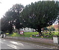
Churchyard perimeter trees, Matson, Gloucester
Trees on the Matson Lane side of the churchyard partially hide St Katharine's Church. http://www.geograph.org.uk/photo/3980065
Image: © Jaggery
Taken: 22 Nov 2013
0.08 miles
4
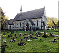
Church and churchyard, Matson, Gloucester
St Katharine's Church (Anglican) viewed from Matson Lane.
Image: © Jaggery
Taken: 22 Nov 2013
0.08 miles
5
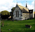
NW side of St Katharine's Church, Matson, Gloucester
Anglican church on the west side of Matson Lane.
Image: © Jaggery
Taken: 22 Nov 2013
0.08 miles
6
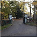
Welcome to Selwyn Care, Matson, Gloucester
The Welcome signs are on fences at the Matson Lane entrance to Matson House.
Image: © Jaggery
Taken: 22 Nov 2013
0.09 miles
7
St Katharine's Church, Matson
On Matson Lane near the dry ski slope.
Image: © michael ely
Taken: 3 Sep 2010
0.10 miles
8
Fishing pond, Matson, Gloucester
Viewed from the edge of Matson Lane.
A Matson Casters Angling Club information and rules board is on a tree nearby. http://www.geograph.org.uk/photo/3980043
Image: © Jaggery
Taken: 22 Nov 2013
0.12 miles
9
SENSS facility, Matson
Attached to the rear of the Moat Primary School buildings, this council-run unit serves people with Special Educational Needs.
Image: © Jonathan Billinger
Taken: 5 Aug 2013
0.12 miles
10
Matson Casters Angling Club board, Gloucester
The information and rules board is on a tree at the edge of a pond http://www.geograph.org.uk/photo/3980047 near Matson Lane.
The small notice above the board shows NO NIGHT FISHING.
Image: © Jaggery
Taken: 22 Nov 2013
0.15 miles


