IMAGES TAKEN NEAR TO
Bilberry Close, GLOUCESTER, GL4 5UT
Introduction
This page details the photographs taken nearby to Bilberry Close, GL4 5UT by members of the Geograph project.
The Geograph project started in 2005 with the aim of publishing, organising and preserving representative images for every square kilometre of Great Britain, Ireland and the Isle of Man.

There are currently over 7.5m images from over14,400 individuals and you can help contribute to the project by visiting https://www.geograph.org.uk
Image Map
Images are licensed for reuse under creativecommons.org/licenses/by-sa/2.0
Notes
- Clicking on the map will re-center to the selected point.
- The higher the marker number, the further away the image location is from the centre of the postcode.
Image Listing (8 Images Found)
Images are licensed for reuse under creativecommons.org/licenses/by-sa/2.0
Image
Details
Distance
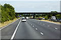
3
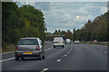
Stroud District : M5 Motorway
The M5 Motorway between Junction 12 and Junction 11A (Brockworth Interchange).
Image: © Lewis Clarke
Taken: 30 Sep 2018
0.15 miles
6
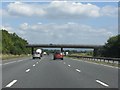
M5 Motorway - minor road overbridge north of Upton St Leonards
Image: © J Whatley
Taken: 31 Aug 2010
0.23 miles
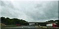
7
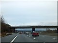
Minor road bridge over M5 north of Upton St Leonards
Image: © David Smith
Taken: 28 Dec 2012
0.23 miles
8
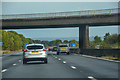
Upton St Leonards : M5 Motorway
The M5 Motorway between Junction 12 and Junction 11A (Brockworth Interchange).
Image: © Lewis Clarke
Taken: 22 Sep 2019
0.23 miles