IMAGES TAKEN NEAR TO
The Plantation, GLOUCESTER, GL4 5TR
Introduction
This page details the photographs taken nearby to The Plantation, GL4 5TR by members of the Geograph project.
The Geograph project started in 2005 with the aim of publishing, organising and preserving representative images for every square kilometre of Great Britain, Ireland and the Isle of Man.

There are currently over 7.5m images from over14,400 individuals and you can help contribute to the project by visiting https://www.geograph.org.uk
Image Map
Images are licensed for reuse under creativecommons.org/licenses/by-sa/2.0
Notes
- Clicking on the map will re-center to the selected point.
- The higher the marker number, the further away the image location is from the centre of the postcode.
Image Listing (23 Images Found)
Images are licensed for reuse under creativecommons.org/licenses/by-sa/2.0
Image
Details
Distance
1
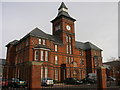
Gloucester, Abbeymead: The Clock Tower
The Clock Tower situated in Abbeymead is now part of a new residential area within Abbeymead, Gloucester and converted into flats.
Image: © Alby
Taken: 24 Jan 2009
0.07 miles
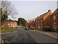
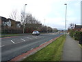
2
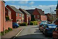
Gloucester : Matson - Bodenham Field
A residential road.
Image: © Lewis Clarke
Taken: 2 Apr 2023
0.08 miles
3
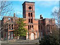
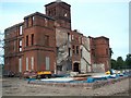
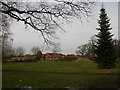
Coney Hill Hospital - Derelict
This was once Coney Hill Hospital, a hospital for the mentally ill. It has been refurbished since this photograph was taken and turned into residential flats. After some of the buildings to the rear were demolished a large extension was added to provide more flats. It sits in the grounds of Clocktower Park,between Abbeydale and Abbeymead, Gloucester.
Image: © Colin Manton
Taken: 18 Mar 2005
0.09 miles
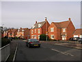
4
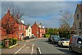
Gloucester : Hucclecote - Kimberland Way
A residential road.
Image: © Lewis Clarke
Taken: 2 Apr 2023
0.09 miles
5
Coney Hill Hospital - Rebuild
A view from the rear of Coney Hill Hospital as it was being rebuilt to provide residential accommodation. the picture shows stairways and extensions at the rear that were demolished to make way for a modern extension. On completion it was renamed The Clocktower.
Image: © Colin Manton
Taken: 4 Jun 2006
0.09 miles
8
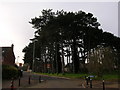
Gloucester, Abbeymead: Dancers Hill
Trees situated in Dancers Hill.
Image: © Alby
Taken: 24 Jan 2009
0.14 miles
10
Gloucester, Abbeymead: The Clock Tower Park, other side
Image: © Alby
Taken: 24 Jan 2009
0.16 miles