1
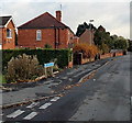
Old Painswick Road, Gloucester
Part of a boomerang-shaped section of the old road to Painswick,
on the east side of the straight course of the B4073 Painswick Road.
Image: © Jaggery
Taken: 22 Nov 2013
0.12 miles
2
Askwith Road bungalows, Gloucester
Viewed from the western (Painswick Road) end.
Image: © Jaggery
Taken: 22 Nov 2013
0.15 miles
3
Ordnance Survey Rivet
This damaged OS rivet can be found on the cemetery wall. It marks a point 29.685m above mean sea level.
Image: © Adrian Dust
Taken: 9 Jul 2022
0.16 miles
4
Painswick Road houses, Gloucester
The houses are NW of The Lampreys junction. http://www.geograph.org.uk/photo/3965535
Image: © Jaggery
Taken: 22 Nov 2013
0.17 miles
5
Morgan Supplies Ltd, Gloucester
Building materials suppliers at 143 Painswick Road.
Image: © Jaggery
Taken: 22 Nov 2013
0.19 miles
6
Beechwood Funeral Services, Coney Hill, Gloucester
Located at 7A Highfield Place, near the entrance to Coney Hill Cemetery and Crematorium.
Image: © Jaggery
Taken: 22 Nov 2013
0.19 miles
7
William Hill, Coney Hill Road, Gloucester
Betting shop at the western end of Coney Hill Road, near the A38 Eastern Avenue junction.
Image: © Jaggery
Taken: 22 Nov 2013
0.19 miles
8
Newton Avenue
Image: © Alex McGregor
Taken: 11 Dec 2014
0.20 miles
9
Eastern Avenue, A38, Gloucester
Looking towards the North from the pedestrian footbridge that crosses Eastern Avenue near to its junction with Coney Hill Road.
Image: © Colin Manton
Taken: 14 Jun 2011
0.21 miles
10
The Lampreys, Gloucester
The Lampreys is a long residential cul-de-sac extending from Painswick Road
on this side to the edge of the A38 Eastern Avenue about 200 metres ahead.
Image: © Jaggery
Taken: 22 Nov 2013
0.22 miles


