IMAGES TAKEN NEAR TO
Green Street, GLOUCESTER, GL3 4RT
Introduction
This page details the photographs taken nearby to Green Street, GL3 4RT by members of the Geograph project.
The Geograph project started in 2005 with the aim of publishing, organising and preserving representative images for every square kilometre of Great Britain, Ireland and the Isle of Man.

There are currently over 7.5m images from over14,400 individuals and you can help contribute to the project by visiting https://www.geograph.org.uk
Image Map
Images are licensed for reuse under creativecommons.org/licenses/by-sa/2.0
Notes
- Clicking on the map will re-center to the selected point.
- The higher the marker number, the further away the image location is from the centre of the postcode.
Image Listing (8 Images Found)
Images are licensed for reuse under creativecommons.org/licenses/by-sa/2.0
Image
Details
Distance
1
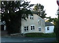
Old Toll House by Green Street, Brockworth
Toll House in the parish of Brockworth (Tewkesbury District), at the junction of Painswick Road (A46) and Green Street.
Gloucestershire County Council.
HER: 4813 https://www.heritagegateway.org.uk/Gateway/Results_Single.aspx?uid=4813&resourceID=108
Surveyed
Milestone Society National ID: GL.BRO01
Image: © Alan Rosevear
Taken: 4 Oct 2014
0.08 miles
2
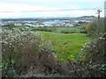
View over Gloucester Business Park
A large trading estate on flat land at the foot of the Cotswold escarpment viewed from the A46 Painswick Road.
In the foreground is Old Man’s Beard – Clematis vitalba.
Image: © Jonathan Billinger
Taken: 21 Dec 2011
0.10 miles
3
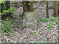
Old Milestone by A46, Green Street, almost opposite new-build house 'Suomi'
The Milestone is located set well back from the road on the SE of the road. Parish of Brockworth (Tewkesbury District). Stone post (plate lost), Painswick plate design, erected by the Cheltenham & Prinknash turnpike trust in the 19th Century. Â
Inscription reads:-
CHELTM / 6 / PAINSWK / 4
Grade II listed. List Entry Number: https://historicengland.org.uk/listing/the-list/list-entry/
Milestone Society National ID: GL_CMSD06
Image: © Roadside Relics
Taken: 5 Apr 2022
0.16 miles
4
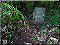
Old Milestone, A46
South East of Green Street, in the vegetation of the SE side of the road. The plate is missing, but the inscription would have indicated Cheltenham 6 / Painswick 4. There is a cut Benchmark on the reverse representing 115.4 m ASL.
Milestone Society National ID: GL_CMSD06
Image: © Mr Red
Taken: 11 Oct 2021
0.16 miles
5

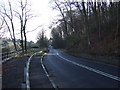
Painswick Road in the woods on Castle Hill, Green Street
Image: © David Smith
Taken: 29 Dec 2017
0.18 miles
6
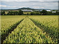
Through the wheat
A view almost due north from a footpath through a wheat field. Churchdown Hill is on the skyline, and Gloucester Business park can be seen through the trees.
Image: © Sharon Loxton
Taken: 8 Jul 2008
0.20 miles