
IMAGES TAKEN NEAR TO
Walham, GLOUCESTER, GL2 9PF
Introduction
This page details the photographs taken nearby to GL2 9PF by members of the Geograph project.
The Geograph project started in 2005 with the aim of publishing, organising and preserving representative images for every square kilometre of Great Britain, Ireland and the Isle of Man.

There are currently over 7.5m images from over14,400 individuals and you can help contribute to the project by visiting https://www.geograph.org.uk
Image Map
Images are licensed for reuse under creativecommons.org/licenses/by-sa/2.0
Notes
- Clicking on the map will re-center to the selected point.
- The higher the marker number, the further away the image location is from the centre of the postcode.
Image Listing (10 Images Found)
Images are licensed for reuse under creativecommons.org/licenses/by-sa/2.0
Image
Details
Distance
1

Flood culvert doing its job
The electric substation is moated by floodwater from the nearby Severn.
Image: © Jonathan Billinger
Taken: 6 May 2012
0.13 miles
2
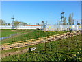
Energy infrastructure
The land surrounding the substation has been developed considerably after several episodes of flooding, see; Image and Image
Image: © Jonathan Billinger
Taken: 13 Apr 2014
0.14 miles
3

Walham electricity substation entrance
Supplies half a million people with leccy.
It came within 2 inches of being completely flooded in July 2007 after a one kilometre wall was built around the site by the armed forces and the fire service.
Image: © Jonathan Billinger
Taken: 22 Aug 2010
0.14 miles
4

Electricity substation on Alney Island, Gloucester
Image: © David Smith
Taken: 20 Oct 2017
0.14 miles
5

Work in progress; flood alieviation
The land surrounding the electricity facility is being upgraded; see Image
Image: © Jonathan Billinger
Taken: 22 Jul 2012
0.14 miles
6

Development by the substation
A lot of earthworking has gone on here in the year since Image was taken.
Image: © Jonathan Billinger
Taken: 14 Apr 2013
0.16 miles
8

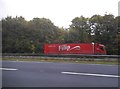
A40 Gloucester Ring Road 2
Looking west on a sunny Sunday morning.
Image: © Jonathan Billinger
Taken: 22 Aug 2010
0.19 miles
9
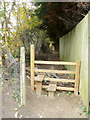
Footpath and stile
Heading north towards the Severn from Walham Lane.
Image: © Jonathan Billinger
Taken: 31 Oct 2010
0.20 miles
10
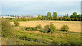
Mean Ham 2011
Photo taken one year after Image
A new building has appeared in the last twelve months to the left of the cathedral tower.
Image: © Jonathan Billinger
Taken: 23 Aug 2011
0.22 miles