
IMAGES TAKEN NEAR TO
Walham, GLOUCESTER, GL2 9NF
Introduction
This page details the photographs taken nearby to GL2 9NF by members of the Geograph project.
The Geograph project started in 2005 with the aim of publishing, organising and preserving representative images for every square kilometre of Great Britain, Ireland and the Isle of Man.

There are currently over 7.5m images from over14,400 individuals and you can help contribute to the project by visiting https://www.geograph.org.uk
Image Map
Images are licensed for reuse under creativecommons.org/licenses/by-sa/2.0
Notes
- Clicking on the map will re-center to the selected point.
- The higher the marker number, the further away the image location is from the centre of the postcode.
Image Listing (22 Images Found)
Images are licensed for reuse under creativecommons.org/licenses/by-sa/2.0
Image
Details
Distance
1

Willows by the Severn
The view from the A40 ring road permits a glimpse of the cathedral above the trees on this May afternoon.
Image: © Jonathan Billinger
Taken: 10 May 2013
0.03 miles
2
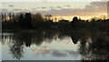
Twyver floods, 4
The dim outline of Severnside Farm can be made out against the dark outline of the trees of Town Ham Wood.
Image: © Jonathan Billinger
Taken: 10 Feb 2014
0.04 miles
3

Striding into the sunset, 2
A gentleman out for a winter's afternoon constitutional on the Mean Ham which was under floodwater only a few days earlier.
The cathedral, safe on its low plateau, glows in the soft light of near-sunset.
Image: © Jonathan Billinger
Taken: 14 Jan 2013
0.08 miles

6

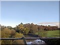
Striding into the sunset, 1
A gentleman out for a winter's afternoon constitutional on the Mean Ham which was under floodwater only a few days earlier.
The modern housing of Dexter Way, St. Oswald's, beyond, is built just above the floodplain.
Image: © Jonathan Billinger
Taken: 14 Jan 2013
0.09 miles
7
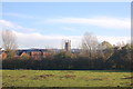
View across Mean Ham from the Gloucester ring-road
Image: © Roger Davies
Taken: 2 Nov 2012
0.10 miles
8

Driving home for Christmas
Well, for those lucky enough to finish work on this Thursday afternoon.
Alney Island (A417) roundabout can be seen ahead.
Image: © Jonathan Billinger
Taken: 22 Dec 2011
0.10 miles
9
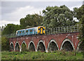
Pool Meadow Viaduct
150 285 on the 17:45 service from Cheltenham to Maesteg crossing Pool Meadow Viaduct. This floods fairly regularly in winter when the Severn bursts its banks.
Image: © Stuart Wilding
Taken: 4 Sep 2009
0.11 miles
10

A40 crossing the river Severn
Junction with the A417 to Ledbury ahead.
Image: © Julian P Guffogg
Taken: 7 Aug 2013
0.11 miles