
IMAGES TAKEN NEAR TO
Fairmile Gardens, GLOUCESTER, GL2 9EA
Introduction
This page details the photographs taken nearby to Fairmile Gardens, GL2 9EA by members of the Geograph project.
The Geograph project started in 2005 with the aim of publishing, organising and preserving representative images for every square kilometre of Great Britain, Ireland and the Isle of Man.

There are currently over 7.5m images from over14,400 individuals and you can help contribute to the project by visiting https://www.geograph.org.uk
Image Map
Images are licensed for reuse under creativecommons.org/licenses/by-sa/2.0
Notes
- Clicking on the map will re-center to the selected point.
- The higher the marker number, the further away the image location is from the centre of the postcode.
Image Listing (50 Images Found)
Images are licensed for reuse under creativecommons.org/licenses/by-sa/2.0
Image
Details
Distance
1
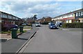
Fairmile Gardens, Gloucester
Looking west along Fairmile Gardens from near the entrance to the Gala Club. http://www.geograph.org.uk/photo/2881970
Image: © Jaggery
Taken: 2 Apr 2012
0.03 miles
2
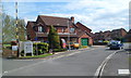
Plock Court houses near the entrance drive to Oxstalls Tennis Centre, Gloucester
The entrance drive http://www.geograph.org.uk/photo/2886493 to the tennis centre is on the left.
Image: © Jaggery
Taken: 2 Apr 2012
0.04 miles
3
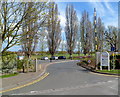
Entrance to Oxstalls Tennis Centre, Gloucester
Viewed from Plock Court. The tennis centre is about 400 metres from this entrance.
http://www.geograph.org.uk/photo/2886498 to a closeup view of the sign showing the facilities available.
Image: © Jaggery
Taken: 2 Apr 2012
0.04 miles
5
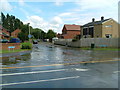
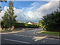
Junction of Tewksbury Road & Plock Court
Taken at 3:55pm
Image: © Nick Mutton 01329 000000
Taken: 22 Jul 2007
0.08 miles
6
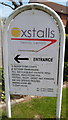
Facilities available in Oxstalls Tennis Centre, Gloucester
The sign is at the Plock Court entrance drive http://www.geograph.org.uk/photo/2886493 to the tennis centre.
Image: © Jaggery
Taken: 2 Apr 2012
0.09 miles
7
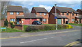
Plock Court, Gloucester
Houses at the western end of Plock Court, viewed from Tewksbury Road.
My guess on seeing the unusual name 'Plock' was that perhaps Gloucester was twinned with Płock (pronounced pwotsk), a city in Poland with a similar population to that of Gloucester.
Research found that this is not the case. Gloucester is not twinned with Płock. The name of this area in the north of Gloucester is first recorded as "le Plock" in 1226.
Image: © Jaggery
Taken: 2 Apr 2012
0.09 miles
8
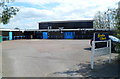
Gala Club, Gloucester
Social club at the eastern end of Fairmile Gardens. http://www.geograph.org.uk/photo/2881986
Image: © Jaggery
Taken: 2 Apr 2012
0.10 miles
9
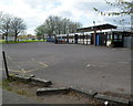
SE side of The Gala Club, Gloucester
Viewed from the Oxstalls Tennis Centre http://www.geograph.org.uk/photo/2886514 side.
The entrance to the club http://www.geograph.org.uk/photo/2881970 is from Fairmile Gardens.
Image: © Jaggery
Taken: 2 Apr 2012
0.10 miles
10
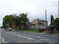
Houses on the Tewkesbury Rd
This was once the main road out of Gloucester to the north. It is still the A38 but a lot of the traffic now goes out of the eastern side of the city and then goes north on the M5 motorway.
Image: © Nigel Mykura
Taken: 30 Sep 2012
0.10 miles