IMAGES TAKEN NEAR TO
Sandhurst Lane, GLOUCESTER, GL2 9AD
Introduction
This page details the photographs taken nearby to Sandhurst Lane, GL2 9AD by members of the Geograph project.
The Geograph project started in 2005 with the aim of publishing, organising and preserving representative images for every square kilometre of Great Britain, Ireland and the Isle of Man.

There are currently over 7.5m images from over14,400 individuals and you can help contribute to the project by visiting https://www.geograph.org.uk
Image Map
Images are licensed for reuse under creativecommons.org/licenses/by-sa/2.0
Notes
- Clicking on the map will re-center to the selected point.
- The higher the marker number, the further away the image location is from the centre of the postcode.
Image Listing (44 Images Found)
Images are licensed for reuse under creativecommons.org/licenses/by-sa/2.0
Image
Details
Distance
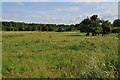
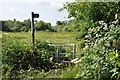
2
Litter strewn field
Off Sandhurst Lane, leaving Gloucester.
Image: © Richard Webb
Taken: 16 Apr 2016
0.02 miles
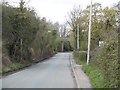
3
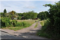
The driveway to Castle Villa
Image: © Nick Mutton 01329 000000
Taken: 24 Jun 2010
0.04 miles
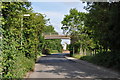
4
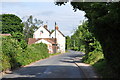
Looking along Sandhurst Road
Image: © Nick Mutton 01329 000000
Taken: 24 Jun 2010
0.06 miles
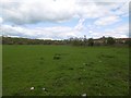
5
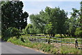
Horses grazing on Sandhurst Road
Image: © Nick Mutton 01329 000000
Taken: 24 Jun 2010
0.08 miles
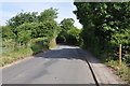
6
Sandhurst Lane
Between the old and new Gloucester bypasses - looking towards the bridge carrying the A40.
Image: © Richard Webb
Taken: 16 Apr 2016
0.08 miles
7
Sandhurst Road, looking towards Walham
Image: © Nick Mutton 01329 000000
Taken: 24 Jun 2010
0.09 miles
8
Looking along Sandhurst Road towards dual carriage way bridge
Image: © Nick Mutton 01329 000000
Taken: 24 Jun 2010
0.10 miles
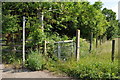
9
Footpath sign on Sandhurst Road
Image: © Nick Mutton 01329 000000
Taken: 24 Jun 2010
0.11 miles
10
Footpath towards Longford
Image: © Nick Mutton 01329 000000
Taken: 24 Jun 2010
0.12 miles