IMAGES TAKEN NEAR TO
Sandhurst Road, GLOUCESTER, GL2 9AA
Introduction
This page details the photographs taken nearby to Sandhurst Road, GL2 9AA by members of the Geograph project.
The Geograph project started in 2005 with the aim of publishing, organising and preserving representative images for every square kilometre of Great Britain, Ireland and the Isle of Man.

There are currently over 7.5m images from over14,400 individuals and you can help contribute to the project by visiting https://www.geograph.org.uk
Image Map
Images are licensed for reuse under creativecommons.org/licenses/by-sa/2.0
Notes
- Clicking on the map will re-center to the selected point.
- The higher the marker number, the further away the image location is from the centre of the postcode.
Image Listing (36 Images Found)
Images are licensed for reuse under creativecommons.org/licenses/by-sa/2.0
Image
Details
Distance
1
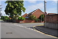
Junction of Sandhurst Road & Greville Close
Image: © Nick Mutton 01329 000000
Taken: 24 Jun 2010
0.01 miles
2
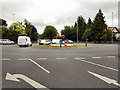
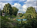
St Oswald's Junction
Roundabout at the junction of St Oswald's Road (A417), Tewkesbury Road (A38), Estcourt Road (A38) and Kings Holm Road (A430).
Image: © David Dixon
Taken: 26 Jul 2010
0.07 miles
3
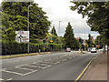
Tewkesbury Road (A38)
Tewkesbury Road approaching St Oswald's Junction
Image: © David Dixon
Taken: 26 Jul 2010
0.07 miles
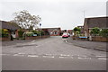
6
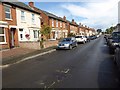
Deans Way
Houses on Deans Way in Gloucester.
Image: © Philip Halling
Taken: 9 Sep 2017
0.10 miles
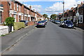
7
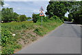
Looking along Sandhurst Road
Image: © Nick Mutton 01329 000000
Taken: 24 Jun 2010
0.10 miles
8

Mural on garage in Sandhurst Road
Image: © Nick Mutton 01329 000000
Taken: 24 Jun 2010
0.10 miles
9
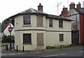
Kingsholm Toll House, Gloucester.
Built for the Cheltenham and Tewkesbury Turnpike Trust in the early 1800's.
Image: © John Bayes
Taken: Unknown
0.12 miles
10
Dean's Way, Gloucester
Semi-detached houses on Dean's Way in Gloucester.
Image: © Philip Halling
Taken: 13 Oct 2012
0.13 miles