
IMAGES TAKEN NEAR TO
Fromebridge/Bristol Road, Fromebridge, GLOUCESTER, GL2 7PF
Introduction
This page details the photographs taken nearby to Fromebridge/Bristol Road, Fromebridge, GL2 7PF by members of the Geograph project.
The Geograph project started in 2005 with the aim of publishing, organising and preserving representative images for every square kilometre of Great Britain, Ireland and the Isle of Man.

There are currently over 7.5m images from over14,400 individuals and you can help contribute to the project by visiting https://www.geograph.org.uk
Image Map
Images are licensed for reuse under creativecommons.org/licenses/by-sa/2.0
Notes
- Clicking on the map will re-center to the selected point.
- The higher the marker number, the further away the image location is from the centre of the postcode.
Image Listing (19 Images Found)
Images are licensed for reuse under creativecommons.org/licenses/by-sa/2.0
Image
Details
Distance
1

Fromebridge Service Station
A Gulf filling station on the A38
Image: © David Smith
Taken: 15 Jun 2018
0.07 miles

3

A barely visible pillbox
Almost hidden by summer growth and the road the remains of a World War II pillbox on a road junction beside the A38 near Frome Bridge.
Image: © Philip Halling
Taken: 8 Jun 2015
0.11 miles
4

Bramble flowers
Wild blackberries in a hedgerow by the lane to Fromebridge.
Image: © Jonathan Billinger
Taken: 27 Jun 2019
0.13 miles
5

Brambly hedge
See Image for a close up of the flowers as at 27th June 2019.
Image: © Jonathan Billinger
Taken: 27 Jun 2019
0.14 miles
6
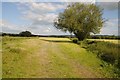
Field beside the River Frome
Harvested silage field beside the River Frome near Frome Bridge.
Image: © Philip Halling
Taken: 8 Jun 2015
0.14 miles


9

A38 Frampton on Severn turnoff
The B4071 junction on the A38 takes you down to Frampton on Severn and the Gloucester and Sharpness canal.
Image: © Vincent Jones
Taken: 10 May 2006
0.15 miles
10

Claypits Hill at the junction of Perry Way
Image: © David Howard
Taken: 28 Jul 2018
0.16 miles