
IMAGES TAKEN NEAR TO
Whitminster, GLOUCESTER, GL2 7NY
Introduction
This page details the photographs taken nearby to GL2 7NY by members of the Geograph project.
The Geograph project started in 2005 with the aim of publishing, organising and preserving representative images for every square kilometre of Great Britain, Ireland and the Isle of Man.

There are currently over 7.5m images from over14,400 individuals and you can help contribute to the project by visiting https://www.geograph.org.uk
Image Map
Images are licensed for reuse under creativecommons.org/licenses/by-sa/2.0
Notes
- Clicking on the map will re-center to the selected point.
- The higher the marker number, the further away the image location is from the centre of the postcode.
Image Listing (95 Images Found)
Images are licensed for reuse under creativecommons.org/licenses/by-sa/2.0
Image
Details
Distance
1
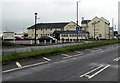
North side of the Whitminster Inn, Whitminster
Viewed across the A38 Bristol Road.
Image: © Jaggery
Taken: 3 Nov 2019
0.02 miles
2

Machinery Development Services in Whitminster
Set back from the east side of the A38 Bristol Road, the main road through Whitminster.
Text on the red barriers shows NO PARKING - ACCESS REQUIRED AT ALL TIMES.
Image: © Jaggery
Taken: 3 Nov 2019
0.02 miles
3
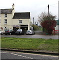
Whitminster Fish & Chips shop, Whitminster
On the east side of Bristol Road, next door to Indian Garden.
Image: © Jaggery
Taken: 3 Nov 2019
0.02 miles
4
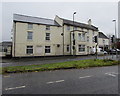
Whitminster Inn, Bristol Road, Whitminster
Text on the information board on the wall on the left shows
Bars - Restaurants - Function Rooms - Accommodation - Open 7 Days a Week.
Part of the A38, Bristol Road is the main road through Whitminster.
Image: © Jaggery
Taken: 3 Nov 2019
0.02 miles
6
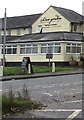
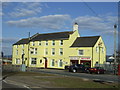
China Garden and Indian Garden name signs, Whitminster
The names of two restaurants/takeaways located here https://www.geograph.org.uk/photo/6314348 on the north wall of the Whitminster Inn.
Image: © Jaggery
Taken: 3 Nov 2019
0.02 miles
7
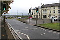
Twin pelican crossings, Bristol Road, Whitminster
Two adjacent separately-controlled pelican crossings across the A38 Bristol Road, the main road through Whitminster. Chambers Dictionary states that pelican in this context is adapted from pedestrian light controlled crossing.
Image: © Jaggery
Taken: 3 Nov 2019
0.02 miles
8
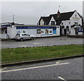
Whitminster Village Stores
Alongside the A38 Bristol Road, the main road through Whitminster.
Old Forge Inn is on the right. https://www.geograph.org.uk/photo/6314149
Image: © Jaggery
Taken: 3 Nov 2019
0.03 miles
10
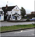
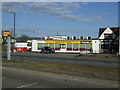
Old Forge Inn, Whitminster
Grade II Listed village pub alongside the A38 Bristol Road.
Historic England records that the pub was known as The Swan Inn until 1779.
Image: © Jaggery
Taken: 3 Nov 2019
0.04 miles