
IMAGES TAKEN NEAR TO
Saul, GLOUCESTER, GL2 7JD
Introduction
This page details the photographs taken nearby to GL2 7JD by members of the Geograph project.
The Geograph project started in 2005 with the aim of publishing, organising and preserving representative images for every square kilometre of Great Britain, Ireland and the Isle of Man.

There are currently over 7.5m images from over14,400 individuals and you can help contribute to the project by visiting https://www.geograph.org.uk
Image Map
Images are licensed for reuse under creativecommons.org/licenses/by-sa/2.0
Notes
- Clicking on the map will re-center to the selected point.
- The higher the marker number, the further away the image location is from the centre of the postcode.
Image Listing (100 Images Found)
Images are licensed for reuse under creativecommons.org/licenses/by-sa/2.0
Image
Details
Distance
1
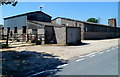
Malthouse Farm, Saul
Viewed from the B4071 High Street.
Image: © Jaggery
Taken: 27 May 2012
0.02 miles
2
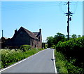
Unusual type of electricity pole in High Street, Saul
Near Malthouse Farm.
Image: © Jaggery
Taken: 27 May 2012
0.02 miles
3
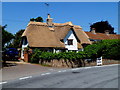
Thatched cottage in High Street, Saul
Possibly dating from c1500, restored in the 20th century. Grade II listed in 1986.
Image: © Jaggery
Taken: 27 May 2012
0.09 miles
4

Canal path, Frampton on Severn
At the edge of the Gloucester and Sharpness Canal.
Image: © Jaggery
Taken: 27 May 2012
0.11 miles
5

Gloucester & Sharpness Canal towpath
Steam tugs, introduced in 1860, eventually replaced the use of horses to tow vessels along the canal. The towpath is now open for walkers and cyclists along its length. Check here http://www.gloucesterdocks.me.uk/canal/canalaccess.htm for access details.
Image: © Pauline E
Taken: 10 Apr 2010
0.12 miles
6

The Gloucester and Sharpness Canal near Frampton on Severn
Looking towards Gloucester.
On the right is a flour mill which originated as a Cadbury's chocolate crumb factory.
Pauline Eccles writes, "The large white concrete structure is a silo built during the time the premises were owned by Cadbury's. Ground cocoa beans and sugar were blended with milk collected from local farms, and the mixture was baked to form chocolate crumb. This was taken by boat to Bournville for final processing. As throughput increased, the huge concrete silo was needed to provide additional storage for the crumb. The factory closed in 1983, and the site is now shared by a number of businesses, including Shipton Mill and AP Fuels.
Planned during the late 18th century, the Gloucester and Berkeley Ship Canal, (now the Gloucester & Sharpness Canal), opened in April 1827. By 1905 traffic exceeded a million tons. The canal links directly to the Stroudwater Navigation at Saul junction and is used mainly by pleasure boaters these days."
Image: © Roger D Kidd
Taken: 29 May 2012
0.13 miles
7

Canal towpath near Frampton on Severn, Gloucestershire
In the distance on the right of the canal is the now disused Sandfield Mill.
Image: © Roger D Kidd
Taken: 29 May 2012
0.14 miles
8

ACP Fuels, Frampton on Severn
Three ACP fuel tankers are parked in the ACP site alongside the Gloucester and Sharpness Canal.
Image: © Jaggery
Taken: 27 May 2012
0.14 miles
9
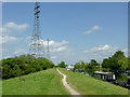
Gloucester and Sharpness Canal approaching Saul, Gloucestershire
The image was taken north-east of Fretherne Bridge, looking towards Gloucester.
Image: © Roger D Kidd
Taken: 29 May 2012
0.14 miles
10

Gloucester and Sharpness Canal approaching Saul, Gloucestershire
The image was taken north-east of Fretherne Bridge, looking towards Gloucester.
Image: © Roger D Kidd
Taken: 29 May 2012
0.14 miles