
IMAGES TAKEN NEAR TO
The Splatt, GLOUCESTER, GL2 7EJ
Introduction
This page details the photographs taken nearby to The Splatt, GL2 7EJ by members of the Geograph project.
The Geograph project started in 2005 with the aim of publishing, organising and preserving representative images for every square kilometre of Great Britain, Ireland and the Isle of Man.

There are currently over 7.5m images from over14,400 individuals and you can help contribute to the project by visiting https://www.geograph.org.uk
Image Map
Images are licensed for reuse under creativecommons.org/licenses/by-sa/2.0
Notes
- Clicking on the map will re-center to the selected point.
- The higher the marker number, the further away the image location is from the centre of the postcode.
Image Listing (84 Images Found)
Images are licensed for reuse under creativecommons.org/licenses/by-sa/2.0
Image
Details
Distance
1

The Gloucester and Sharpness Canal
View to the south down the Gloucester and Sharpness Canal, viewed from Splatt Bridge at Frampton on Severn.
Image: © Philip Halling
Taken: 11 Feb 2012
0.04 miles
2
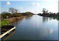
Canal south of Splatt Bridge, Frampton on Severn
The Gloucester and Sharpness Canal here is 30 metres wide (about 100 ft)
Image: © Jaggery
Taken: 18 Mar 2012
0.04 miles
3
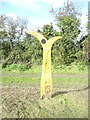
National Cycle Network signpost, Frampton on Severn
Along the Gloucester & Sharpness canal. Route 41.
Bristol Cathedral 34½, Gloucester Cathedral 12½
Millennium Time Trail ID: MP179 see http://umap.openstreetmap.fr/en/map/sustrans-mileposts_71773#14/51.7570/-2.3765
Image: © Mr Red
Taken: 7 Oct 2020
0.05 miles
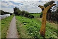
5
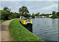
Narrowboats moored near Splatt Swing Bridge
Image: © Mat Fascione
Taken: 27 Aug 2024
0.06 miles
6
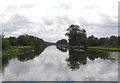
The Gloucester and Sharpness Canal
Looking south from Splatt Bridge.
Image: © Colin Bews
Taken: 20 Jul 2012
0.07 miles
7
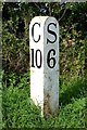
Old milemarker by the Gloucester & Sharpness Canal, south of Splatt Bridge
Milemarker by the Gloucester & Sharpness Canal, in parish of Frampton on Severn (Stroud District), South of Splatt Bridge, No 7.
Inscription reads:-
: G / 10 : : S / 6 :
(To Gloucester and Sharpness)
Grade II listed.
List Entry Number: 1091309 https://historicengland.org.uk/listing/the-list/list-entry/1091309
Surveyed
Milestone Society National ID: GSC-10
Image: © Milestone Society
Taken: Unknown
0.08 miles
8
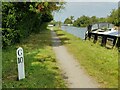
Milepost along the Gloucester and Sharpness Canal
10 miles to Gloucester, 6 miles to Sharpness.
Image: © Mat Fascione
Taken: 27 Aug 2024
0.08 miles
9
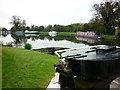
Swing bridge at the Splatt
Taken on the eastern side of Splatt Bridge, Church End, Frampton-on-Severn, Gloucestershire, I am looking south west across the Gloucester and Sharpness Canal.
Image: © Carroll Pierce
Taken: 2 Nov 2015
0.09 miles
10
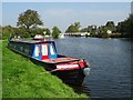
Narrowboat moored near Splatt Bridge
Narrowboat moored near Splatt Bridge on the Gloucester and Sharpness Canal.
Image: © Philip Halling
Taken: 16 Sep 2020
0.09 miles