
IMAGES TAKEN NEAR TO
Ryalls Lane, GLOUCESTER, GL2 7AH
Introduction
This page details the photographs taken nearby to Ryalls Lane, GL2 7AH by members of the Geograph project.
The Geograph project started in 2005 with the aim of publishing, organising and preserving representative images for every square kilometre of Great Britain, Ireland and the Isle of Man.

There are currently over 7.5m images from over14,400 individuals and you can help contribute to the project by visiting https://www.geograph.org.uk
Image Map
Images are licensed for reuse under creativecommons.org/licenses/by-sa/2.0
Notes
- Clicking on the map will re-center to the selected point.
- The higher the marker number, the further away the image location is from the centre of the postcode.
Image Listing (42 Images Found)
Images are licensed for reuse under creativecommons.org/licenses/by-sa/2.0
Image
Details
Distance
1
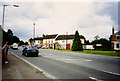
Bristol Road, Cambridge, Gloucestershire
Image: © Keith Edkins
Taken: 31 Jul 1996
0.02 miles
2
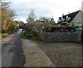
Ryalls Lane, Cambridge
A view to the ESE along Ryalls Lane in the Gloucestershire village of Cambridge.
Image: © Jaggery
Taken: 18 Dec 2011
0.03 miles
3

Perimeter fence razor wire, Bristol Road, Cambridge
Viewed opposite Ryalls Lane. Coils of razor wire top the perimeter fence of premises on the east side of Bristol Road (A38) in the Gloucestershire village of Cambridge.
Image: © Jaggery
Taken: 18 Dec 2011
0.04 miles
4
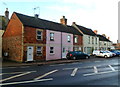
Bell Cottages, Cambridge
Viewed across Bristol Road (A38) in the Gloucestershire village of Cambridge.
Image: © Jaggery
Taken: 18 Dec 2011
0.04 miles
5
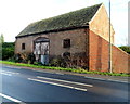
Brick windows in a roadside building, Cambridge
The building is on the east side of Bristol Road (A38) near the Ryalls Lane junction in the Gloucestershire village of Cambridge. The windows are made of overlapping bricks with gaps.
Image: © Jaggery
Taken: 18 Dec 2011
0.04 miles
6
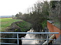
River Cam, Cambridge
Viewed from Bristol Road (A38). The Cam is a small river in Gloucestershire. It flows into the Gloucester and Sharpness Canal about a mile behind the camera. Before the canal was opened in 1827, the Cam flowed into the River Severn at Frampton Pill.
Image: © Jaggery
Taken: 18 Dec 2011
0.04 miles
7
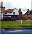
Depth on road gauge, Bristol Road, Cambridge
To the left of the Bristol Road sign is a thin vertical gauge marked off at 1 foot intervals from 1 to 3.
At the top of the gauge is DEPTH ON ROAD. The gauge is located near the Ryalls Lane junction, a few metres from the River Cam, http://www.geograph.org.uk/photo/2735544 a small river in Gloucestershire.
Image: © Jaggery
Taken: 18 Dec 2011
0.04 miles
8

Corner of Ryalls Lane and Bristol Road, Cambridge
On the left is Old Farm, Ryalls Lane. This Cambridge is a small village in Gloucestershire.
Image: © Jaggery
Taken: 18 Dec 2011
0.04 miles
9

Bristol Road houses, Cambridge
Viewed across the A38 Bristol Road in the Gloucestershire village of Cambridge.
Image: © Jaggery
Taken: 18 Dec 2011
0.05 miles
10
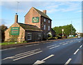
The George Inn, Cambridge
Located between Bristol Road (the A38) and the River Cam in the Gloucestershire village of Cambridge.
Image: © Jaggery
Taken: 18 Dec 2011
0.06 miles