IMAGES TAKEN NEAR TO
Stirrup Close, GLOUCESTER, GL2 5GE
Introduction
This page details the photographs taken nearby to Stirrup Close, GL2 5GE by members of the Geograph project.
The Geograph project started in 2005 with the aim of publishing, organising and preserving representative images for every square kilometre of Great Britain, Ireland and the Isle of Man.

There are currently over 7.5m images from over14,400 individuals and you can help contribute to the project by visiting https://www.geograph.org.uk
Image Map
Images are licensed for reuse under creativecommons.org/licenses/by-sa/2.0
Notes
- Clicking on the map will re-center to the selected point.
- The higher the marker number, the further away the image location is from the centre of the postcode.
Image Listing (26 Images Found)
Images are licensed for reuse under creativecommons.org/licenses/by-sa/2.0
Image
Details
Distance
1
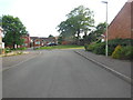
A horsy housing estate
This is The Gallops. Behind the photographer is Stirrup Close, and nearby are Horseshoe Way, Harness Close, and The Forge.
Image: © HelenK
Taken: 8 Jun 2016
0.05 miles
2
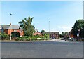
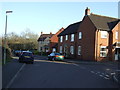
Soren Larsen Way junction
The junction between the A430 and Soren Larsen Way.
Image: © Pebble
Taken: 9 Sep 2023
0.08 miles
3
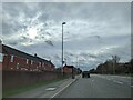
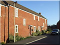
Bus stop and houses on the A430 heading south
Image: © Rob Purvis
Taken: 4 Feb 2024
0.08 miles
6
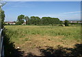
Fields, Hempsted
Hempsted can still identify itself as a village, thanks to fields such as these which separate it from the city of Gloucester, whose cathedral can be seen on the left.
Image: © Derek Harper
Taken: 23 Jun 2010
0.14 miles
8
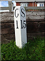
Milepeg on the Gloucester to Sharpness canal
The towpath in the area of Hempstead deviates slightly from the canal edge near modern housing (Soren Larsen Way). The mile marker was re-instated during the building of the estate.
The canal was originally called the Gloucester - Berkeley Canal.
Gloucester 1 / Sharpness 15
Milestone Society National ID: GSC-01
Image: © Mr Red
Taken: 14 Oct 2020
0.16 miles
9
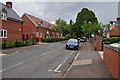
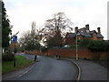
Hempsted Lane, Hempsted
Recently built houses on Hempsteds Lane in Hempsted.
Image: © Philip Halling
Taken: 7 May 2011
0.17 miles