
IMAGES TAKEN NEAR TO
Dimore Close, GLOUCESTER, GL2 4QQ
Introduction
This page details the photographs taken nearby to Dimore Close, GL2 4QQ by members of the Geograph project.
The Geograph project started in 2005 with the aim of publishing, organising and preserving representative images for every square kilometre of Great Britain, Ireland and the Isle of Man.

There are currently over 7.5m images from over14,400 individuals and you can help contribute to the project by visiting https://www.geograph.org.uk
Image Map
Images are licensed for reuse under creativecommons.org/licenses/by-sa/2.0
Notes
- Clicking on the map will re-center to the selected point.
- The higher the marker number, the further away the image location is from the centre of the postcode.
Image Listing (39 Images Found)
Images are licensed for reuse under creativecommons.org/licenses/by-sa/2.0
Image
Details
Distance
1
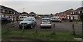
Dinmore Close, Hardwicke
On the south side of Elmgrove Road West.
Image: © Jaggery
Taken: 22 Jan 2017
0.03 miles
2
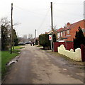
Elmgrove Road West, Hardwicke
From the corner of Dinmore Close along Elmgrove Road West towards Sellars Road.
Image: © Jaggery
Taken: 22 Jan 2017
0.06 miles
3
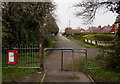
Metal barriers at the SE end of Elmgrove Road West, Hardwicke
The barriers prevent vehicular misuse of the footpath to Westbourne Drive behind the camera.
Image: © Jaggery
Taken: 22 Jan 2017
0.07 miles
4
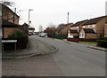
Westbourne Drive, Hardwicke
South along Westbourne Drive from the corner of Ashgrove Close.
Image: © Jaggery
Taken: 22 Jan 2017
0.07 miles
5
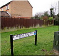
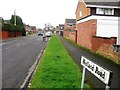
Elmgrove Road West this way, Hardwicke
The sign faces Westbourne Drive alongside a footpath to Elmgrove Road West.
Image: © Jaggery
Taken: 22 Jan 2017
0.07 miles
6
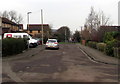
Ashgrove Close, Hardwicke
Along Ashgrove Close towards Westbourne Drive.
Image: © Jaggery
Taken: 22 Jan 2017
0.08 miles
7
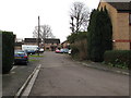
South along Ashgrove Close, Hardwicke
Ashgrove Close is a cul-de-sac on the east side of Westbourne Drive.
Image: © Jaggery
Taken: 22 Jan 2017
0.10 miles
8
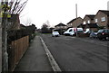
Ashgrove Close, Hardwicke
Cul-de-sac viewed from the corner of Westbourne Drive.
A damaged Neighbourhood Watch Area notice is on the lamppost on the left.
Image: © Jaggery
Taken: 22 Jan 2017
0.11 miles
10
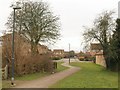
Path, Quedgeley
Footpath EHA31/1 makes its way from a patch of open land towards Ashgrove Close and Westbourne Drive.
Image: © Derek Harper
Taken: 12 Mar 2010
0.12 miles