
IMAGES TAKEN NEAR TO
Azalea Gardens, GLOUCESTER, GL2 4GA
Introduction
This page details the photographs taken nearby to Azalea Gardens, GL2 4GA by members of the Geograph project.
The Geograph project started in 2005 with the aim of publishing, organising and preserving representative images for every square kilometre of Great Britain, Ireland and the Isle of Man.

There are currently over 7.5m images from over14,400 individuals and you can help contribute to the project by visiting https://www.geograph.org.uk
Image Map
Images are licensed for reuse under creativecommons.org/licenses/by-sa/2.0
Notes
- Clicking on the map will re-center to the selected point.
- The higher the marker number, the further away the image location is from the centre of the postcode.
Image Listing (14 Images Found)
Images are licensed for reuse under creativecommons.org/licenses/by-sa/2.0
Image
Details
Distance
1
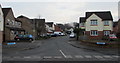
Hillcot Close, Quedgeley
Cul-de-sac on the southeast side of Severnvale Drive.
Image: © Jaggery
Taken: 22 Jan 2017
0.11 miles
2
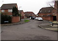
Hasfield Close, Quedgeley
Cul-de-sac on the north side of Clearwater Drive.
Image: © Jaggery
Taken: 22 Jan 2017
0.15 miles
3
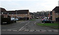
Deerhurst Place, Quedgeley
Cul-de-sac on the east side of Severnvale Drive.
Image: © Jaggery
Taken: 22 Jan 2017
0.16 miles
4
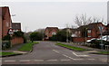
Clearwater Drive, Quedgeley
From Severnvale Drive along Clearwater Drive towards the Hasfield Close junction, ahead on the right.
Image: © Jaggery
Taken: 22 Jan 2017
0.16 miles
5
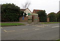
Severnvale Drive bus stop and shelter near Deerhurst Place, Quedgeley
On bus route 12 to Gloucester city centre.
Image: © Jaggery
Taken: 22 Jan 2017
0.19 miles
6
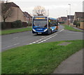
Stagecoach bus in Severnvale Drive, Quedgeley
Stagecoach bus number 37322 is on bus route 12 to Gloucester city centre.
Image: © Jaggery
Taken: 22 Jan 2017
0.20 miles
7

Apperley Drive, Quedgeley
Cul-de-sac on the east side of Severnvale Drive.
Image: © Jaggery
Taken: 22 Jan 2017
0.21 miles
8
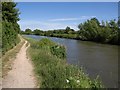
Gloucester & Sharpness Canal
The ship canal cuts across the northwest corner of the square.
Image: © Derek Harper
Taken: 23 Jun 2010
0.22 miles
9
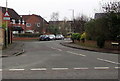
The Causeway, Quedgeley
Suburban road on the west side of Severnvale Drive.
Image: © Jaggery
Taken: 22 Jan 2017
0.22 miles
10
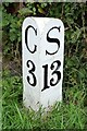
Old milemarker by the Gloucester & Sharpness Canal, Quedgeley parish
Milemarker by the Gloucester & Sharpness Canal, in parish of Quedgeley (Gloucester District), 500m Southwest of Rea Bridge (No 18).
Inscription reads:-
: G / 3 : : S / 13 :
Grade II listed.
List Entry Number: 1141225
https://historicengland.org.uk/listing/the-list/list-entry/1141225
Surveyed
Milestone Society National ID: GSC-03
Image: © Milestone Society
Taken: Unknown
0.22 miles