
IMAGES TAKEN NEAR TO
Collett Close, GLOUCESTER, GL2 4BG
Introduction
This page details the photographs taken nearby to Collett Close, GL2 4BG by members of the Geograph project.
The Geograph project started in 2005 with the aim of publishing, organising and preserving representative images for every square kilometre of Great Britain, Ireland and the Isle of Man.

There are currently over 7.5m images from over14,400 individuals and you can help contribute to the project by visiting https://www.geograph.org.uk
Image Map
Images are licensed for reuse under creativecommons.org/licenses/by-sa/2.0
Notes
- Clicking on the map will re-center to the selected point.
- The higher the marker number, the further away the image location is from the centre of the postcode.
Image Listing (49 Images Found)
Images are licensed for reuse under creativecommons.org/licenses/by-sa/2.0
Image
Details
Distance
1
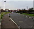
Bridge Keepers Way, Hardwicke
Towards recently-built houses near the Gloucester and Sharpness Canal, viewed in January 2017.
Image: © Jaggery
Taken: 22 Jan 2017
0.08 miles
2
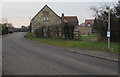
Sellars Road bus stop near Elmgrove Road West, Hardwicke
The stop is on Stagecoach bus route 12 to Gloucester city centre via Quedgeley.
Image: © Jaggery
Taken: 22 Jan 2017
0.08 miles
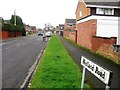
4
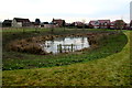
Pond near Bridge Keepers Way, Hardwicke
Below the west (left) side of this road. http://www.geograph.org.uk/photo/5263742
Image: © Jaggery
Taken: 22 Jan 2017
0.08 miles
5
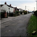
Elmgrove Road West, Hardwicke
From the corner of Sellars Road.
Image: © Jaggery
Taken: 22 Jan 2017
0.09 miles
6
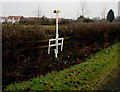
Oil pipeline marker, Sellars Road, Hardwicke
Text on the base of the marker shows NO DIGGING - N/S(S) OIL PIPELINE.
An 0845 number is shown for enquiries. Another phone number is shown in the event of an emergency.
Image: © Jaggery
Taken: 22 Jan 2017
0.10 miles
8

Bridge Keepers Way name sign, Hardwicke
The sign shows that this road http://www.geograph.org.uk/photo/5263742 leads to six cul-de-sacs.
Image: © Jaggery
Taken: 22 Jan 2017
0.12 miles
9
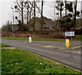
Distances from Hardwicke in Stroud District, Gloucestershire
The sign on the west side of the School Lane and Sellars Road
roundabout is 1½ (miles) from Elmore, 2½ from Longney, 3 from Epney.
Image: © Jaggery
Taken: 22 Jan 2017
0.12 miles
10
Quedgeley this way, Hardwicke
Showing Quedgeley 1 (mile), a sign points left along School Lane.
Image: © Jaggery
Taken: 22 Jan 2017
0.13 miles