IMAGES TAKEN NEAR TO
Baird Road, GLOUCESTER, GL2 2GB
Introduction
This page details the photographs taken nearby to Baird Road, GL2 2GB by members of the Geograph project.
The Geograph project started in 2005 with the aim of publishing, organising and preserving representative images for every square kilometre of Great Britain, Ireland and the Isle of Man.

There are currently over 7.5m images from over14,400 individuals and you can help contribute to the project by visiting https://www.geograph.org.uk
Image Map
Images are licensed for reuse under creativecommons.org/licenses/by-sa/2.0
Notes
- Clicking on the map will re-center to the selected point.
- The higher the marker number, the further away the image location is from the centre of the postcode.
Image Listing (35 Images Found)
Images are licensed for reuse under creativecommons.org/licenses/by-sa/2.0
Image
Details
Distance
1
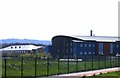
Quedgeley: South West Snooker Academy
Situated on an industrial estate on the southern outskirts of Gloucester, the South West Snooker Academy is a purpose built venue providing world-class practice facilities for professionals (a number of the world's best players belong to a management stable based here), and offering coaching from officially qualified coaches. It also holds some of the minor professional tournaments.
Image: © Chris Downer
Taken: 14 Nov 2012
0.08 miles
2
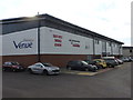
Jackson's Art Supplies, Quedgeley, Gloucester
Located in the Aquarius Centre, Waterwells Business Park, viewed along Edison Close.
Image: © Jaggery
Taken: 27 Jan 2019
0.11 miles
3
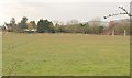
Playing field, Naas Lane
A view through a hedge on Naas Lane. On the left is Waterwells Farm, and on the right business units at Brearley Court on Waterwells Business Park.
Image: © Derek Harper
Taken: 12 Mar 2010
0.12 miles
4
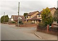
Two turnings, Naas Lane
The first in Needham Avenue, which forms a crescent off Naas Lane. The second is Hunts Grove View, an exceedingly short cul-de-sac.
Image: © Derek Harper
Taken: 12 Mar 2010
0.15 miles
5
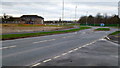
Former RAF Quedgeley, 3
This gridsquare has some industrial vestiges but is mostly filling up with housing.
Image: © Jonathan Billinger
Taken: 27 Dec 2012
0.16 miles
6
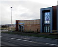
Badham Pharmacy, Rudloe Drive, Quedgeley, Gloucester
Part of the recently-opened Kingsway Health Centre https://www.geograph.org.uk/photo/6035039 viewed in January 2019.
A July 2018 Google Street View shows the health centre under construction.
Image: © Jaggery
Taken: 27 Jan 2019
0.16 miles
7
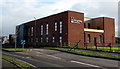
Kingsway Health Centre, Quedgeley, Gloucester
Recently-opened health centre viewed across Rudloe Drive in January 2019.
A July 2018 Google Earth View shows the building under construction.
Image: © Jaggery
Taken: 27 Jan 2019
0.16 miles
8
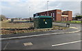
Rudloe Drive electricity substation, Quedgeley, Gloucester
The dark green cabinet is an electricity substation. Its identifier is N7020256-1 KINGSWAY.
Kingsway Health Centre https://www.geograph.org.uk/photo/6035039 is in the background.
Image: © Jaggery
Taken: 27 Jan 2019
0.17 miles
9
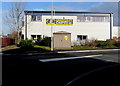
Quedgeley Carpets, Gloucester
Trade discount warehouse on the corner of Edison Close and Stanley Court.
The cabinet is a Western Power Distribution electricity substation.
Its identifier is WATERWELLS 01770.
Image: © Jaggery
Taken: 27 Jan 2019
0.17 miles