IMAGES TAKEN NEAR TO
Dishforth Drive Kingsway, GLOUCESTER, GL2 2FD
Introduction
This page details the photographs taken nearby to Dishforth Drive Kingsway, GL2 2FD by members of the Geograph project.
The Geograph project started in 2005 with the aim of publishing, organising and preserving representative images for every square kilometre of Great Britain, Ireland and the Isle of Man.

There are currently over 7.5m images from over14,400 individuals and you can help contribute to the project by visiting https://www.geograph.org.uk
Image Map
Images are licensed for reuse under creativecommons.org/licenses/by-sa/2.0
Notes
- Clicking on the map will re-center to the selected point.
- The higher the marker number, the further away the image location is from the centre of the postcode.
Image Listing (1 Images Found)
Images are licensed for reuse under creativecommons.org/licenses/by-sa/2.0
Image
Details
Distance
1
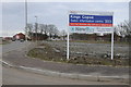
Sales board Taylor Wimpey Home
Sales board Taylor Wimpey Home on the site which was formerly RAF Quedgeley.
Image: © Philip Halling
Taken: 16 Feb 2013
0.21 miles