
IMAGES TAKEN NEAR TO
London Road, GLOUCESTER, GL2 0RS
Introduction
This page details the photographs taken nearby to London Road, GL2 0RS by members of the Geograph project.
The Geograph project started in 2005 with the aim of publishing, organising and preserving representative images for every square kilometre of Great Britain, Ireland and the Isle of Man.

There are currently over 7.5m images from over14,400 individuals and you can help contribute to the project by visiting https://www.geograph.org.uk
Image Map
Images are licensed for reuse under creativecommons.org/licenses/by-sa/2.0
Notes
- Clicking on the map will re-center to the selected point.
- The higher the marker number, the further away the image location is from the centre of the postcode.
Image Listing (131 Images Found)
Images are licensed for reuse under creativecommons.org/licenses/by-sa/2.0
Image
Details
Distance
1
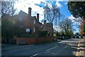
Gloucester : London Road
A road heading through Gloucester.
Image: © Lewis Clarke
Taken: 2 Apr 2023
0.01 miles
2
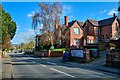
Gloucester : London Road B4063
A road heading through Gloucester.
Image: © Lewis Clarke
Taken: 2 Apr 2023
0.01 miles
3
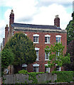
115 London Road, Gloucester
A house of c1800 with stepped voussoirs to the windows. Grade II listed.
Image: © Stephen Richards
Taken: 18 May 2015
0.02 miles
4
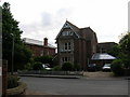
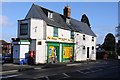
Gloucester: Redcliffe House
Redcliffe House, former hotel, situated in Wotton, Gloucester.
Image: © Alby
Taken: 30 May 2005
0.04 miles
6
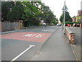
Horton Road
On the left stands the former campus of Redcliffe College 'a mission training centre and theological college ... specialising in training men, women and families working in Christian mission and ministry' and the first institution to train women as missionaries. Earlier in 2016 the College moved to a building in Gloucester Cathedral close.
Image: © HelenK
Taken: 6 Jun 2016
0.06 miles
7
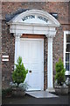
Door to Wotton House
Door and surrounding arch and pillars to Wotton House.
Image: © Philip Halling
Taken: 1 Feb 2014
0.06 miles
8
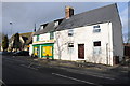
Wotton News and Stores and St Catherine's church
Wotton News and Stores with St Catherine's church in the background.
Image: © Philip Halling
Taken: 1 Feb 2014
0.07 miles
9
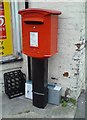
Postbox in London Road, Gloucester
At Wotton News shop
Image: © Schlosser67
Taken: 29 Jan 2008
0.07 miles
10
![Gloucester buildings [12]](https://s0.geograph.org.uk/geophotos/06/58/06/6580632_aa837803_120x120.jpg)
Gloucester buildings [12]
Wotton House, in Horton Road, is a large house built in brick in the early 18th century - the house is depicted in an engraving of 1712. There have been alterations and additions in the mid 19th century and in the 20th century. In recent times the building has been used as a training college for domestic science and as a nurses home. It is currently home to an International School. There is another image of the building at Image Listed, grade II, with details at: https://historicengland.org.uk/listing/the-list/list-entry/1271681
The cathedral city and county town of Gloucestershire, Gloucester lies on the River Severn and is linked via the Gloucester and Sharpness Canal to the river’s estuary. Founded by the Romans in AD 97, the city gained its first charter in 1155. In the Middle Ages there were a large number of monastic establishments including St Peter's Abbey founded in 679 - later Gloucester Cathedral. Until the construction of the Severn Bridge in 1966, Gloucester was the lowest road bridging point on the River Severn. The city has a long association with the aerospace business, including the Gloster Aircraft Company.
Image: © Michael Dibb
Taken: 1 Jun 2020
0.07 miles