
IMAGES TAKEN NEAR TO
Little Elmbridge, GLOUCESTER, GL2 0HH
Introduction
This page details the photographs taken nearby to Little Elmbridge, GL2 0HH by members of the Geograph project.
The Geograph project started in 2005 with the aim of publishing, organising and preserving representative images for every square kilometre of Great Britain, Ireland and the Isle of Man.

There are currently over 7.5m images from over14,400 individuals and you can help contribute to the project by visiting https://www.geograph.org.uk
Image Map
Images are licensed for reuse under creativecommons.org/licenses/by-sa/2.0
Notes
- Clicking on the map will re-center to the selected point.
- The higher the marker number, the further away the image location is from the centre of the postcode.
Image Listing (16 Images Found)
Images are licensed for reuse under creativecommons.org/licenses/by-sa/2.0
Image
Details
Distance
1
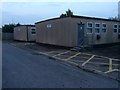
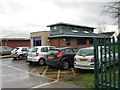
Sir Thomas Rich's school - prefab classrooms
Many of us were taught in prefabricated classrooms such as these.
'Sir Thomas Rich was born in Gloucester in 1601 as the entry in the Baptismal Register of St John's, Northgate shows. He was sent to school in London and after studying at the newly founded Wadham College, Oxford, worked in the city of London in the wine importing trade. He bought the manor of Sonning, near Reading, and become MP for Reading. He was created a baronet by Charles II. In his will of 1666 he left his Gloucester house in Eastgate and £6000 to establish a school in Gloucester for twenty poor boys. The money was mainly invested in farm land and the rent was to pay for the running of the school. The school was opened in 1668 one year after Sir Thomas Rich's death. He was buried in the parish church at Sonning and his ornate tomb may be seen under the church tower. The school, known as the Blue Coat Hospital, was to be run on the lines of Christ's Hospital and a master and matron were appointed to teach and care for the boys.' https://strschool.co.uk/about/history It moved to this site in 1964.
Image: © HelenK
Taken: 3 Nov 2014
0.07 miles
2
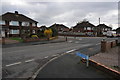
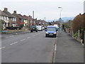
Little Elmbridge
Little Elmbridge at the junction with Manor Park.
Image: © Philip Halling
Taken: 26 Feb 2011
0.07 miles
3
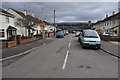
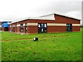
Elmleaze, Elmbridge
Elmlease with St Thomas Rich's school in the background.
Image: © Philip Halling
Taken: 26 Feb 2011
0.11 miles
4
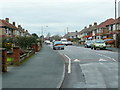
Nine Elms Road
Older housing in a suburb of Gloucester.
Image: © Jonathan Billinger
Taken: 10 Dec 2010
0.13 miles
8
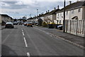
Elmleaze, Elmbridge
Road on a housing estate at Elmbridge in the suburbs of Gloucester.
Image: © Philip Halling
Taken: 26 Feb 2011
0.17 miles
9
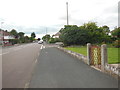
Nine Elms Road
With Orchard Road leading off to the right. Not much evidence of an orchard, and I expect the elms all died of Dutch elm disease a while back.
Image: © HelenK
Taken: 11 Jul 2016
0.20 miles
10
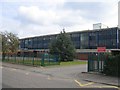
Sir Thomas Rich's School, Gloucester
Founded in 1668 as the Blue Coat Hospital for boys from the will of Sir Thomas Rich, it changed name to Sir Thomas Rich's in 1882. The school moved to this current site in Elmbridge in 1964 from its previous site in Barton Street (Image) and today has been awarded Beacon school status. For more information see http://www.school-portal.co.uk/GroupHomepage.asp?GroupID=14257
Image: © David Stowell
Taken: 18 Sep 2005
0.21 miles