
IMAGES TAKEN NEAR TO
Grange Court, TEWKESBURY, GL20 8TG
Introduction
This page details the photographs taken nearby to Grange Court, GL20 8TG by members of the Geograph project.
The Geograph project started in 2005 with the aim of publishing, organising and preserving representative images for every square kilometre of Great Britain, Ireland and the Isle of Man.

There are currently over 7.5m images from over14,400 individuals and you can help contribute to the project by visiting https://www.geograph.org.uk
Image Map
Images are licensed for reuse under creativecommons.org/licenses/by-sa/2.0
Notes
- Clicking on the map will re-center to the selected point.
- The higher the marker number, the further away the image location is from the centre of the postcode.
Image Listing (25 Images Found)
Images are licensed for reuse under creativecommons.org/licenses/by-sa/2.0
Image
Details
Distance
1
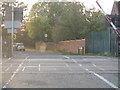
Northway level crossing
The barriers are just rising after the passage of a lengthy southbound freight train.
Image: © Peter Whatley
Taken: 15 Oct 2011
0.04 miles
2
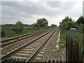
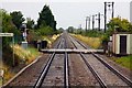
Level crossing, Northway, looking South
Looking towards Ashchurch station. The bridge in the distance is a footbridge for residents of Northway.
Image: © Jennifer Luther Thomas
Taken: 20 Sep 2006
0.05 miles
3
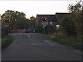
Waiting for the train at Northway
A southbound freight train would arrive within a few seconds.
Image: © Peter Whatley
Taken: 15 Oct 2011
0.05 miles
4
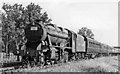
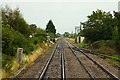
Long empty coaching stock train northbound on the main line near Ashchurch
View southward from Northway level-crossing, on the ex-Midland Bristol - Birmingham main line. The train - of about 18 coaches - needed a Stanier 8F 2-8-0 (No. 48223) to handle it. The reporting number M861 on the smokebox indicates a relief holiday express, however.
Image: © Ben Brooksbank
Taken: 30 Jul 1948
0.05 miles
6
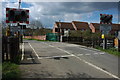
Northway level crossing
Part of the Northway housing estate can be seen on the other side of the crossing.
Image: © Philip Halling
Taken: 12 Apr 2008
0.06 miles
8
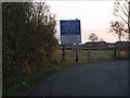
Level crossing warning sign 2
The eastern access to Northway level crossing is via two 90-degree bends on a single-track lane. Sign placement is "creative"! Large vehicles would have some difficulty negotiating the bends, let alone the level crossing.
Image: © Peter Whatley
Taken: 15 Oct 2011
0.08 miles
9
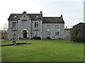
The Northway
The Northway is a large pub serving the Northway housing estate which now surrounds the much older house. Formerly it was Northway House which was built in 1851 for William Woodward. The building is Grade II listed.
Historic England description
Former private house now public house. Dated and initialled. 'W.W. 1851' (William Woodward) on limestone shield on right gable end. Blue lias with ashlar quoins. Fishscale ceramic tile roof. Blue lias stacks with ashlar quoins. Wall blue lias with brick piers. Rectangular plan to house with extensions to right of entrance front. 2½ storeys. Symmetrical, 3-windowed facade to main body with gabled projecting central bay with central round- headed entrance with keystone. Part-glazed double door within porch. Canted oriel window above. Two-light round-headed sash windows to flanking bays within limestone surrounds. Hoodmoulded with console supports over ground floor Windows. Return, left, two bay windows to ground floor with pierced parapet. Two-bay extension to right of entrance front lit by 3-light stone-mullioned casements with glazing bars. Axial and gable end stacks. Wall adjoining right gable end of extension falls away gradually from c4.5m to c2m in height to right in a series of concave sweeps. Moulded cappings and ball finials to wall piers. Interior not inspected.
Source: https://www.historicengland.org.uk/listing/the-list/list-entry/1304388
Image: © Philip Halling
Taken: 27 Dec 2016
0.09 miles
10
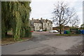
The Northway, Northway
The local pub. The building predates most of the surrounding housing development.
Image: © Bill Boaden
Taken: 31 Oct 2014
0.09 miles