
IMAGES TAKEN NEAR TO
Milne Pastures, TEWKESBURY, GL20 8SG
Introduction
This page details the photographs taken nearby to Milne Pastures, GL20 8SG by members of the Geograph project.
The Geograph project started in 2005 with the aim of publishing, organising and preserving representative images for every square kilometre of Great Britain, Ireland and the Isle of Man.

There are currently over 7.5m images from over14,400 individuals and you can help contribute to the project by visiting https://www.geograph.org.uk
Image Map
Images are licensed for reuse under creativecommons.org/licenses/by-sa/2.0
Notes
- Clicking on the map will re-center to the selected point.
- The higher the marker number, the further away the image location is from the centre of the postcode.
Image Listing (51 Images Found)
Images are licensed for reuse under creativecommons.org/licenses/by-sa/2.0
Image
Details
Distance
1
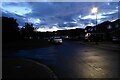
Twilight on Milne Pastures
Houses on Milne Pastures. 10pm on a mid-July evening and the light is going.
Image: © Philip Halling
Taken: 18 Jul 2023
0.02 miles
2
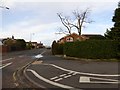
Green Lane, Tewkesbury
A cul-de-sac into a housing estate. There is a footpath and cycle track (hence the white cycle markings) into the industrial estate
Image: © David Smith
Taken: 31 Dec 2015
0.04 miles
3
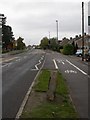
Newtown, milestone
On Ashchurch Road, giving distances to Tewkesbury, Winchcomb (sic), Evesham & Stow.
Image: © Mike Faherty
Taken: 31 Oct 2010
0.04 miles
4

Old Milestone by the A438, Ashchurch Road, Newtown
Metal plate attached to stone post by the A438, in parish of ASHCHURCH (TEWKESBURY District), Ashchurch Road, Newtown, opposite Tewkesbury School, on the verge, on North side of road. Tewkesbury plate, erected by the Tewkesbury turnpike trust in the 19th century.
Inscription reads:-
TEWKESBURY
1
WINCHCOMB
9
EVESHAM
11
STOW
19
Rivet on top.
Grade II listed.
List Entry Number: 1091356 https://historicengland.org.uk/listing/the-list/list-entry/1091356
Milestone Society National ID: GL_TWSW01.
Image: © J Higgins
Taken: 1 Dec 2006
0.04 miles
5

Old Milestone by the A438, Ashchurch Road, Newtown
Metal plate attached to stone post by the A438, in parish of ASHCHURCH (TEWKESBURY District), Ashchurch Road, Newtown, opposite Tewkesbury School, on the verge, on North side of road. Tewkesbury plate, erected by the Tewkesbury turnpike trust in the 19th century. An earlier photograph can be found here https://www.geograph.org.uk/photo/6068743.
Inscription reads:-
TEWKESBURY
1
WINCHCOMB
9
EVESHAM
11
STOW
19
Rivet on top.
Grade II listed.
List Entry Number: 1091356 https://historicengland.org.uk/listing/the-list/list-entry/1091356
Milestone Society National ID: GL_TWSW01.
Image: © Bryan Boskett
Taken: 17 Aug 2023
0.04 miles
6
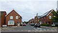
Furrowfield Park, Tewkesbury
With its communications mast peering over the roof tops.
Image: © Russel Wills
Taken: 16 Jul 2018
0.05 miles
7
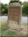
Milestone on Ashchurch Road
This milestone on Ashchurch Road is one mile to the east of Tewkesbury. The plate on the milestone reads 'Tewkesbury 1, Winchcomb 9, Evesham 11, Stow 19'. It is just inches from the kerb of this busy road making it difficult to photograph. I had to wait for a break in the flow of the traffic to quickly get a photograph of it. I have driven past it many times, telling myself I must photograph someday, well today's the day. The milestone is Grade II listed.
Historic England description
Milestone. C19. Limestone with cast-iron plaque with inscription 'TEWKESBURY / 1 / WINCHCOMB / 9 / EVESHAM / 11 / STOW / 19' in raised Lettering on segmental-headed stone clm in height.
Source: https://www.historicengland.org.uk/listing/the-list/list-entry/1091356
Image: © Philip Halling
Taken: 10 Aug 2016
0.06 miles
10
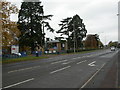
Tewkesbury School
On Ashchurch Road. http://www.tewkesburyschool.org/
Image: © Mike Faherty
Taken: 31 Oct 2010
0.08 miles