
IMAGES TAKEN NEAR TO
Pear Orchard, TEWKESBURY, GL20 8RG
Introduction
This page details the photographs taken nearby to Pear Orchard, GL20 8RG by members of the Geograph project.
The Geograph project started in 2005 with the aim of publishing, organising and preserving representative images for every square kilometre of Great Britain, Ireland and the Isle of Man.

There are currently over 7.5m images from over14,400 individuals and you can help contribute to the project by visiting https://www.geograph.org.uk
Image Map
Images are licensed for reuse under creativecommons.org/licenses/by-sa/2.0
Notes
- Clicking on the map will re-center to the selected point.
- The higher the marker number, the further away the image location is from the centre of the postcode.
Image Listing (14 Images Found)
Images are licensed for reuse under creativecommons.org/licenses/by-sa/2.0
Image
Details
Distance
1
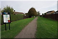
Footpath through the estate
This path was probably here before the houses of Northway were erected.
Image: © Bill Boaden
Taken: 31 Oct 2014
0.07 miles
3
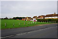
The green space is about to get smaller
This section of open space is for sale for development.
Image: © Bill Boaden
Taken: 31 Oct 2014
0.13 miles
4
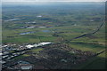
Aerial view of Northway
The housing estate at Northway can be seen in the near distance with the M5 motorway passing by, on the left are some of the industrial units that have mushroomed around junction 9 of the motorway. The village of Twyning, which is quite a large village but looks insignificant is in the centre. In the distance the Malvern Hills can be seen on the left and further away near the horizon to the right of centre are the Abberley Hills.
Image: © Philip Halling
Taken: 12 Apr 2008
0.16 miles
5
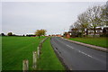
The Park, Northway
Much of Northway is new residential development. A bit of green space has been retained on the left.
Image: © Bill Boaden
Taken: 31 Oct 2014
0.18 miles
6
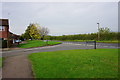
The northern edge of Northway
Hardwick Bank Road currently marks the north edge of the housing development, but you wonder how long it will be before it crosses the road to the fields the other side.
Image: © Bill Boaden
Taken: 31 Oct 2014
0.18 miles
7
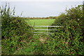
Fields to the north of Northway
The fields are currently separated from the housing development by quite a thick hedge.
Image: © Bill Boaden
Taken: 31 Oct 2014
0.18 miles
8
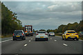
Tewkesbury Borough : M5 Motorway
The M5 Motorway between Junction 9 (Ashchurch Interchange) and Junction 8 (Strensham).
Image: © Lewis Clarke
Taken: 30 Sep 2018
0.19 miles
9
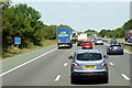
Northbound M5, Gloucestershire
Passing Driver Location Sign B68.9
Driver location signs are now widely used across the motorway and A–road network. First introduced in 2003, they complement distance marker posts. Both types of marker post display the distances in kilometres from a nominal start point but driver location signs are designed to be read by motorists or their passengers when, for instance, they need to pass details to the emergency services. They give the same location information as distance marker posts, but more visibly on larger signs. They are normally spaced at 500-metre intervals along the nearside verge but if obstacles (eg sliproads or bridges) prevent signs from being erected at these locations, then the interval is reduced to either 400 or 300 metres.
Driver location signs display three pieces of information:
• The road identifier (eg M5 in this example)
• The carriageway identifier – The letter on the second line of the signs, usually “A” or “B”, tells the emergency services or the Highways Agency in which direction you are travelling. The letter “A” ("Away from London") normally denotes carriageways leaving London and "B" ("Back to London") is used for carriageways going to London. In this example, "B" tells us that we are on the northbound carriageway.
• The location (which is identical to the location given on marker posts). Distances are accurate to within 20 metres and are generally quoted from the beginning of the motorway. In this example, we are 68.9 km from the start of the motorway.
http://www.dft.gov.uk/ha/standards/ians/pdfs/ian93r1.pdf DFT Interim Advice Note (December 2010)
http://www.theaa.com/motoring_advice/breakdown_advice/driver-location-signs.html The AA
http://www.sabre-roads.org.uk/wiki/index.php?title=Driver_Location_Signs SABREPassing Driver Location Sign B248.0
Image: © David Dixon
Taken: 25 Jul 2018
0.19 miles
10
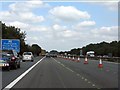
M5 Motorway near Northway
The "route confirmatory" sign shows South Wales in parentheses, indicating that the M5 leads to a route which goes to South Wales. Despite heading due north at this point, the sign is correct as the onward route is via the M50 (Ross Spur) which leaves the M5 near Strensham. The roadworks were for bridge repairs slightly south of this point.
Image: © J Whatley
Taken: 31 Aug 2010
0.20 miles