IMAGES TAKEN NEAR TO
Henry Crescent, TEWKESBURY, GL20 7TN
Introduction
This page details the photographs taken nearby to Henry Crescent, GL20 7TN by members of the Geograph project.
The Geograph project started in 2005 with the aim of publishing, organising and preserving representative images for every square kilometre of Great Britain, Ireland and the Isle of Man.

There are currently over 7.5m images from over14,400 individuals and you can help contribute to the project by visiting https://www.geograph.org.uk
Image Map
Images are licensed for reuse under creativecommons.org/licenses/by-sa/2.0
Notes
- Clicking on the map will re-center to the selected point.
- The higher the marker number, the further away the image location is from the centre of the postcode.
Image Listing (7 Images Found)
Images are licensed for reuse under creativecommons.org/licenses/by-sa/2.0
Image
Details
Distance
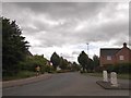
1
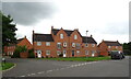
New Housing Development
On what I thought was the road from Walton Cardiff to Treddington.
The road has been stopped with the concrete bollards and houses springing up evertwhere. Not yet on the online OS map.
Image: © Bob Embleton
Taken: 17 Oct 2005
0.06 miles
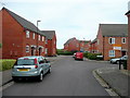
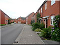
3
New housing on Cambrian Road, Walton Cardiff
Image: © JThomas
Taken: 9 Aug 2021
0.08 miles
4
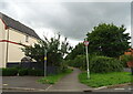
Hawkmoth Close
Red-brick 90's housing on the outskirts of Tewkesbury.
Image: © Jonathan Billinger
Taken: 11 Jul 2010
0.11 miles
5
Hawkmoth Close 2
Looking west within this housing development near Tewkesbury.
Image: © Jonathan Billinger
Taken: 11 Jul 2010
0.11 miles
6
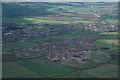
Housing development, Tewkesbury
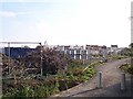
In the foreground is a controversial housing development which has been built over the last ten years. The town of Tewkesbury is in the middle distance with the abbey to the left of centre. Beyond the town is Severn Ham, a large meadow which is cut for hay each summer. The River Severn can be seen in the distance, with the Queenhill Bridge carrying the M50 motorway over the Severn near the top of the pictures and to the far right the river is passing Upper Lode.
Image: © Philip Halling
Taken: 12 Apr 2008
0.15 miles
7
Monterey Road, the Wheatpieces, Tewkesbury
Image: © David Smith
Taken: 16 Jun 2018
0.25 miles