IMAGES TAKEN NEAR TO
Hill Close, TEWKESBURY, GL20 7ET
Introduction
This page details the photographs taken nearby to Hill Close, GL20 7ET by members of the Geograph project.
The Geograph project started in 2005 with the aim of publishing, organising and preserving representative images for every square kilometre of Great Britain, Ireland and the Isle of Man.

There are currently over 7.5m images from over14,400 individuals and you can help contribute to the project by visiting https://www.geograph.org.uk
Image Map
Images are licensed for reuse under creativecommons.org/licenses/by-sa/2.0
Notes
- Clicking on the map will re-center to the selected point.
- The higher the marker number, the further away the image location is from the centre of the postcode.
Image Listing (15 Images Found)
Images are licensed for reuse under creativecommons.org/licenses/by-sa/2.0
Image
Details
Distance
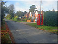
2
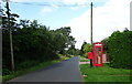
Lower Westmancote
Showing position of Postbox No. GL20 12.
See Image] for postbox.
Image: © JThomas
Taken: 13 Aug 2021
0.02 miles
3
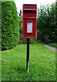
Elizabeth II postbox, Lower Westmancote
Image: © JThomas
Taken: 13 Aug 2021
0.03 miles
4
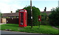
Elizabeth II postbox and telephone box, Lower Westmancote
Postbox No. GL20 45.
See Image] for postbox.
Image: © JThomas
Taken: 13 Aug 2021
0.03 miles
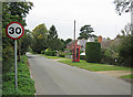
5
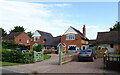
Lower Westmancote
View west along Hill Close at this quiet village.
Image: © Trevor Rickard
Taken: 2 Nov 2009
0.04 miles
6
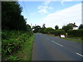
Kemerton Road, Lower Westmancote
Looking west.
Image: © JThomas
Taken: 13 Aug 2021
0.08 miles
8
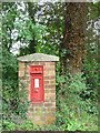
Post Box, Westmancote
A Victorian post box in a brick surround in Lower Westmancote, to the south west of Bredon Hill
Image: © Dave Bushell
Taken: 26 Aug 2004
0.14 miles
9
Lower Westmancote
Lower Westmancote, looking west towards Pershore.
Image: © Dave Bushell
Taken: 5 Oct 2005
0.14 miles
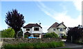
10
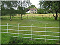
Cottage in Westmancote
Cottage on the road from Westmancote through to B4080.
Image: © Philip Halling
Taken: 22 Jul 2008
0.15 miles