
IMAGES TAKEN NEAR TO
Monks Field Way, TEWKESBURY, GL20 5UE
Introduction
This page details the photographs taken nearby to Monks Field Way, GL20 5UE by members of the Geograph project.
The Geograph project started in 2005 with the aim of publishing, organising and preserving representative images for every square kilometre of Great Britain, Ireland and the Isle of Man.

There are currently over 7.5m images from over14,400 individuals and you can help contribute to the project by visiting https://www.geograph.org.uk
Image Map
Images are licensed for reuse under creativecommons.org/licenses/by-sa/2.0
Notes
- Clicking on the map will re-center to the selected point.
- The higher the marker number, the further away the image location is from the centre of the postcode.
Image Listing (88 Images Found)
Images are licensed for reuse under creativecommons.org/licenses/by-sa/2.0
Image
Details
Distance
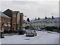
2
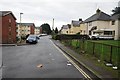
Housing on Priors Park
Housing on Priors Park on a road off Despenser Road.
Image: © Philip Halling
Taken: 12 Jan 2014
0.07 miles
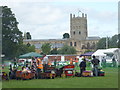
4
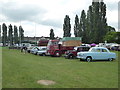
Tewkesbury Rugby Football Club
The site was hosting a miniature steam engine rally.
Image: © Chris Allen
Taken: 24 Jun 2017
0.09 miles
5
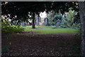
Tewkesbury Cemetery
The slightly wilder eastern edge.
Image: © Bill Boaden
Taken: 31 Oct 2014
0.10 miles
6
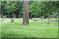
Tewkesbury Cemetery
Currently with a carpet of daisies.
Image: © Bill Boaden
Taken: 4 Jun 2018
0.11 miles
7
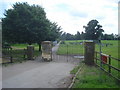
Path to Prior's Park
Looking southwards at the footpath junction along the path to the extensive housing estates east of the town centre. The trees on the hill hide the town cemetery.
Image: © Trevor Rickard
Taken: 5 Jun 2008
0.12 miles
8
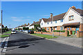
Margaret Road, Tewkesbury
That would be Margaret of Anjou, Queen of England, one of the Royals behind the decades of conflict known as the Wars of the Roses. She was present at The Battle of Tewkesbury which was fought over this area in 1471. Margaret was captured and her son the Prince of Wales, was killed. https://en.wikipedia.org/wiki/Margaret_of_Anjou
Image: © Des Blenkinsopp
Taken: 24 Aug 2019
0.12 miles
9
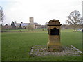
Multi-purpose monument
This solid block has information plaques on all four faces. One lists the numerous charters granted to Tewkesbury since the Earls of Gloucester first in the twelfth century; one notes that Henry VIII's Dissolution of the abbey was prevented after the Burgesses of Tewkesbury bought it for £483; one marks the fact that these fields are known as the Vineyards, part of the battle of 1471; the last plaque stands as a memorial to the old Holme Castle, which used to exist in this area.
Holme Castle was originally a Saxon residence of some stature and home to the local barony. It was destroyed by a fire in 1140 and rebuilt. However, that abode of the Earl of Gloucester and other lords was also lost by as early as the fourteenth century.
Image: © Neil Owen
Taken: 10 Mar 2014
0.13 miles
10

Bryan Douglas Soden
Brian Douglas SODEN Private 24107294 Royal Regiment of Wales. He was on mobile patrol in Brompton Street, Ardoyne Belfast Northern Ireland when he was shot by IRA sniper in the head on the 19 June 1972 aged 20 He was taken to the Royal Victoria Hospital, but died later.
Image: © Alf Beard
Taken: 20 Feb 2018
0.13 miles