
IMAGES TAKEN NEAR TO
St. Marys Lane, TEWKESBURY, GL20 5SF
Introduction
This page details the photographs taken nearby to St. Marys Lane, GL20 5SF by members of the Geograph project.
The Geograph project started in 2005 with the aim of publishing, organising and preserving representative images for every square kilometre of Great Britain, Ireland and the Isle of Man.

There are currently over 7.5m images from over14,400 individuals and you can help contribute to the project by visiting https://www.geograph.org.uk
Image Map
Images are licensed for reuse under creativecommons.org/licenses/by-sa/2.0
Notes
- Clicking on the map will re-center to the selected point.
- The higher the marker number, the further away the image location is from the centre of the postcode.
Image Listing (1964 Images Found)
Images are licensed for reuse under creativecommons.org/licenses/by-sa/2.0
Image
Details
Distance
1
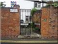
Entrance to Friends Burial Ground
Entrance to Friends Burial Ground off St Mary's Lane in Tewkesbury. Today the former burial ground is a private garden which is open to the public on some days.
Image: © Philip Halling
Taken: 6 Aug 2020
0.00 miles
2
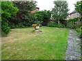
Friends Burial Ground
This former Friends Burial Ground dating from 1660 off St Mary's Lane in Tewkesbury is now a private garden which is open to the public on some days.
Image: © Philip Halling
Taken: 6 Aug 2020
0.01 miles
3
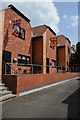
Modern houses in Tewkesbury
Modern houses on St Mary's Road in Tewkesbury. Note the banners with coats of arms, each represents one of the aristocrats who fought at the battle of Tewkesbury in 1471. See the site when it was about to be redeveloped Image]
Image: © Philip Halling
Taken: 8 Jul 2019
0.01 miles
4
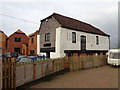
The Old Chandlery, St Mary's Lane, Tewkesbury
"Saint Mary’s Lane is within the area of medieval settlement of
Tewkesbury and as such is a site of archaeological interest. A standing
building on the site is Grade II listed and is noted by the Gloucestershire
Site and Monument Record (SMR 8016) as an 18th century tannery drying
house." from an Archaeology Data Service PDF.
I believe it has been redeveloped since the document was produced.
Image: © Jeff Gogarty
Taken: 17 Dec 2015
0.01 miles
5
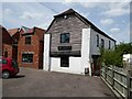
The Old Chandlery
The Old Chandlery, now converted into residential accommodation. This building is Grade II listed and described as 'General boat store/warehouse, formerly tannery drying house.' in its listing description. See: https://historicengland.org.uk/listing/the-list/list-entry/1201297
Image: © Philip Halling
Taken: 1 Jun 2021
0.01 miles
6
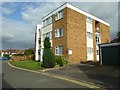
Small block of flats
A small block of flats on St Mary's Lane in Tewkesbury, based on the architectural style the building appears to date from the late 1960s or early 1970s.
Image: © Philip Halling
Taken: 6 Sep 2016
0.01 miles
8
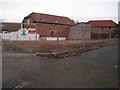
Redevelopment site, St Mary's Lane
Redevelopment site on St Mary's Lane beside the Mill Avon in Tewkesbury. See this same site in 2019 after it has been redeveloped Image
Image: © Philip Halling
Taken: 21 Dec 2013
0.01 miles
9
St Mary's Road, Tewkesbury (3)
Turning away from the river.
Image: © Jeff Gogarty
Taken: 17 Dec 2015
0.01 miles
10
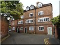
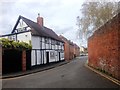
Former stocking maker's cottages
Former stocking maker's cottages dating from the mid-18th century. Until the late 19th century stocking making was a major industry in Tewkesbury. In the 1720s Daniel Defoe reported 1 in 4 of the population were employed in stocking making.
Image: © Philip Halling
Taken: 6 Aug 2020
0.02 miles