
IMAGES TAKEN NEAR TO
Wenlock Road, TEWKESBURY, GL20 5JD
Introduction
This page details the photographs taken nearby to Wenlock Road, GL20 5JD by members of the Geograph project.
The Geograph project started in 2005 with the aim of publishing, organising and preserving representative images for every square kilometre of Great Britain, Ireland and the Isle of Man.

There are currently over 7.5m images from over14,400 individuals and you can help contribute to the project by visiting https://www.geograph.org.uk
Image Map
Images are licensed for reuse under creativecommons.org/licenses/by-sa/2.0
Notes
- Clicking on the map will re-center to the selected point.
- The higher the marker number, the further away the image location is from the centre of the postcode.
Image Listing (638 Images Found)
Images are licensed for reuse under creativecommons.org/licenses/by-sa/2.0
Image
Details
Distance
1
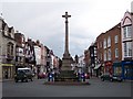
Tewkesbury War Memorial
Looking west south west down the main road to the Abbey this commands attention being located on a busy roundabout.
Image: © Bob Embleton
Taken: 19 Apr 2005
0.05 miles
3

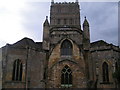
Tewkesbury Abbey, nave lierne vault boss: 'The Adoration of the Magi'
Image: © Michael Garlick
Taken: 12 Jul 2017
0.05 miles
4
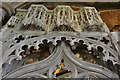
Tewkesbury Abbey: The Wakeman Cenotaph 3
Image: © Michael Garlick
Taken: 12 Jul 2017
0.05 miles
5

Tewkesbury Abbey: Green man at the front of the Founders Chantry
Image: © Michael Garlick
Taken: 12 Jul 2017
0.05 miles
6

Tewkesbury Abbey: The Beauchamp Chantry erected ca. 1430 by Isabella, Countess of Warwick
Image: © Michael Garlick
Taken: 12 Jul 2017
0.05 miles
7
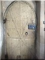
The Sacristy door, Tewkesbury Abbey
This door to the Sacristy in Tewkesbury Abbey is very historic. The rear of door pictured here is covered with horse armour salvaged after the Battle of Tewkesbury in 1471. There is even a hole on the right side above the horizontal strap caused by an arrow.
Image: © Philip Halling
Taken: 16 Jun 2022
0.05 miles
8
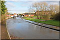
Link Road, Tewkesbury
Water trapped in a minor dip in Link Road as it approaches a bridge over the flooded River Swilgate in Tewkesbury.
Image: © Philip Halling
Taken: 25 Nov 2012
0.06 miles
9
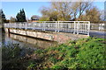
Bridge over the flooded River Swilgate
Bridge carrying Link Road over the flooded River Swilgate in Tewkesbury.
Image: © Philip Halling
Taken: 25 Nov 2012
0.07 miles
10
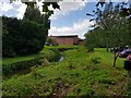
River Swilgate with houses on Lanescourt, Tewkesbury
Image: © Jeff Gogarty
Taken: 20 Aug 2020
0.08 miles