
IMAGES TAKEN NEAR TO
Mowbray Avenue, TEWKESBURY, GL20 5FA
Introduction
This page details the photographs taken nearby to Mowbray Avenue, GL20 5FA by members of the Geograph project.
The Geograph project started in 2005 with the aim of publishing, organising and preserving representative images for every square kilometre of Great Britain, Ireland and the Isle of Man.

There are currently over 7.5m images from over14,400 individuals and you can help contribute to the project by visiting https://www.geograph.org.uk
Image Map
Images are licensed for reuse under creativecommons.org/licenses/by-sa/2.0
Notes
- Clicking on the map will re-center to the selected point.
- The higher the marker number, the further away the image location is from the centre of the postcode.
Image Listing (53 Images Found)
Images are licensed for reuse under creativecommons.org/licenses/by-sa/2.0
Image
Details
Distance
1
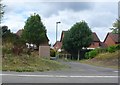
Courtney Close
This is a small pedestrian entrance into the housing estate on the south side of Tewkesbury between the old Gloucester road and the A38 bypass which reroutes through traffic away from the ancient town centre. These are the backs of houses in Courtney Close.
Image: © Nigel Mykura
Taken: 28 Aug 2011
0.06 miles
2
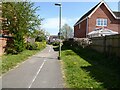
Path through Stonehills estate
This path through Stonehills estate roughly follows the route of the former footpath.
Image: © Philip Halling
Taken: 24 Apr 2021
0.06 miles
3
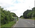
Bus shelter by A38 south of Priors Park
The Priors Park housing is opposite, shielded by trees and hedge.
Image: © David Smith
Taken: 16 Jun 2018
0.08 miles
4
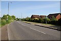
Gloucester Road, Tewkesbury
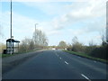
Gloucester Road approaching Tewkesbury to the north of Stonehills Roundabout. This road used to be the A38 until the building of the partial town bypass which carries traffic from the stonehills Roundabout to the Newtown Road to the east of Tewkesbury.
Image: © Philip Halling
Taken: 3 May 2014
0.09 miles
5
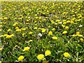
Dandelion flowers
A field of dandelions.
Image: © Philip Halling
Taken: 24 Apr 2021
0.12 miles
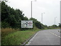
7
The A38 before Stonehills Roundabout
This is the extreme south end of Tewkesbury
Image: © David Howard
Taken: 3 Aug 2019
0.13 miles
8
Bus stop by Gloucester Road, Tewkesbury
Image: © David Smith
Taken: 15 Aug 2022
0.14 miles
10
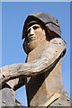
Detail of Sculpted Victorious Knight
This 5m (16ft) tall victorious knight on horseback sculpted from green oak has just been erected on Stonehills roundabout on the A38 to the south of Tewkesbury. The victorious knight represents the Yorkest forces, whilst the nearby horse Image] represents the defeated Lancastrian forces. The Battle of Tewkesbury took place on the 4th May 1471 which resulted in the death of Prince Edward, Prince of Wales, and the capture of his mother Margaret of Anjou. They were created by sculptor, Phil Bews from the Forest of Dean. The title of the piece - "Arrivall" - is taken from the 1471 account of the recovery of Henry VI's English throne by Edward IV.
Image: © Philip Halling
Taken: 3 May 2014
0.16 miles