
IMAGES TAKEN NEAR TO
Clarks Alley, TEWKESBURY, GL20 5AU
Introduction
This page details the photographs taken nearby to Clarks Alley, GL20 5AU by members of the Geograph project.
The Geograph project started in 2005 with the aim of publishing, organising and preserving representative images for every square kilometre of Great Britain, Ireland and the Isle of Man.

There are currently over 7.5m images from over14,400 individuals and you can help contribute to the project by visiting https://www.geograph.org.uk
Image Map
Images are licensed for reuse under creativecommons.org/licenses/by-sa/2.0
Notes
- Clicking on the map will re-center to the selected point.
- The higher the marker number, the further away the image location is from the centre of the postcode.
Image Listing (1332 Images Found)
Images are licensed for reuse under creativecommons.org/licenses/by-sa/2.0
Image
Details
Distance
1
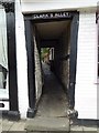
Clark's Alley
Alleys are a numerous feature of the town of Tewkesbury, this is Clark's Alley on the west side of the High Street.
Image: © Philip Halling
Taken: 8 Sep 2017
0.01 miles
2
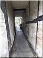
In Clark's Alley
Alleys are a numerous feature of the town of Tewkesbury, this in Clark's Alley on the west side of the High Street.
Image: © Philip Halling
Taken: 8 Sep 2017
0.01 miles
3

The rear of Tudor House Hotel
The rear of Tudor House Hotel viewed from the banks of the Mill Avon. Parts of the rear of the building appears older than the front. In the foreground a narrowboat is moored.
Image: © Philip Halling
Taken: 27 Jun 2018
0.01 miles
4

Cares Alley
Alleys are a numerous feature of the town of Tewkesbury, this is Cares Alley on the west side of the High Street.
Image: © Philip Halling
Taken: 8 Sep 2017
0.01 miles
5

In Cares Alley
Alleys are a numerous feature of the town of Tewkesbury, this picture is in Cares Alley on the west side of the High Street.
Image: © Philip Halling
Taken: 8 Sep 2017
0.01 miles
6

Remains of a sandstone wall
I have never noticed this red sandstone wall on Red Lane in Tewkesbury before. It appears to be the remains or the base of a higher wall, reminiscent of a town wall. The wall is just feet from the river and it is likely the stone was brought down the River Severn from the north Worcestershire/south Shropshire area which this rock is common.
Image: © Philip Halling
Taken: 17 Jun 2014
0.01 miles
7
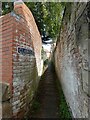
Tewkesbury - Clark's Alley
Tewkesbury has over thirty narrow alleys, courts and yards - see a list of them here https://tewkesburyhistory.org/Tewkesburys-Alleys
Clark’s Alley links Red Lane to the High Street - it has unusual brick ridges which can be seen in this photo which were to help with gaining purchase when moving heavy loads up the slope. For much more information on this alley, see https://tewkesburyhistory.org/Clark%E2%80%99s-Alley
Image: © Rob Farrow
Taken: 29 May 2023
0.01 miles
8

Rear of the Tudor House Museum
The rear of the Tudor House Hotel, compare with the view of the front on the Tewkesbury's High Street Image
Image: © Philip Halling
Taken: 11 Dec 2020
0.01 miles
9
![Tewkesbury features [11]](https://s2.geograph.org.uk/geophotos/06/89/47/6894778_abf2a222_120x120.jpg)
Tewkesbury features [11]
This section of sandstone wall in Red Lane is 14th or 15th century, raised in brick in the 18t century. Possibly part of the quay wall. Listed, grade II, with details at: https://historicengland.org.uk/listing/the-list/list-entry/1282751
The market town of Tewkesbury is sited at the confluence of the River Severn and the River Avon, some 9 miles north of Gloucester, close to the border with Worcestershire. Founded in Saxon times, the town thrived and there are many medieval and Tudor buildings including Tewkesbury Abbey, bought by the townspeople to use as their parish church. One of the decisive battles of the Wars of the Roses was the Battle of Tewkesbury, which took place on 4 May 1471.
Image: © Michael Dibb
Taken: 18 May 2021
0.01 miles
