IMAGES TAKEN NEAR TO
Church Lane, GLOUCESTER, GL19 4NP
Introduction
This page details the photographs taken nearby to Church Lane, GL19 4NP by members of the Geograph project.
The Geograph project started in 2005 with the aim of publishing, organising and preserving representative images for every square kilometre of Great Britain, Ireland and the Isle of Man.

There are currently over 7.5m images from over14,400 individuals and you can help contribute to the project by visiting https://www.geograph.org.uk
Image Map
Images are licensed for reuse under creativecommons.org/licenses/by-sa/2.0
Notes
- Clicking on the map will re-center to the selected point.
- The higher the marker number, the further away the image location is from the centre of the postcode.
Image Listing (107 Images Found)
Images are licensed for reuse under creativecommons.org/licenses/by-sa/2.0
Image
Details
Distance
1
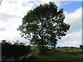
Ash tree and the beginning of a footpath
Image: © Jonathan Thacker
Taken: 19 Sep 2017
0.09 miles
2
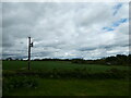
Farmland north of Eldersfield Churchyard
Image: © Basher Eyre
Taken: 22 May 2021
0.10 miles
3
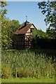
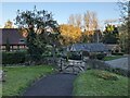
Dovecote in Eldersfield
Red brick timber-framed dovecote and village pond is situated opposite the church. For more information on Eldersfield see: http://www.british-history.ac.uk/report.asp?compid=42860
Image: © Philip Halling
Taken: 25 Aug 2007
0.10 miles
4
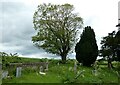
St John the Baptist, Eldersfield: churchyard (ii)
Image: © Basher Eyre
Taken: 22 May 2021
0.10 miles
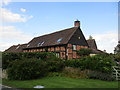
5

Converted farm buildings, Eldersfield
Now housing
Image: © Jonathan Thacker
Taken: 19 Sep 2017
0.10 miles
6
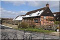
Timber-framed cottage
Timber-framed converted farm building opposite Eldersfield church.
Image: © Philip Halling
Taken: 19 Mar 2018
0.10 miles
7
House at Eldersfield
A converted cowshed https://www.britishlistedbuildings.co.uk/101098827-cowshed-on-west-side-of-farmyard-approximately-90-metres-east-of-church-of-st-john-eldersfield#.WiHdOTdpHVI
Image: © Jonathan Thacker
Taken: 19 Sep 2017
0.11 miles
8
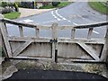
Entrance gates to St. John the Baptist church (Eldersfield)
These wooden gates leads the walker into the grounds of St. John the Baptist parish church, and these may date from the 1960s.
Image: © Fabian Musto
Taken: 4 Nov 2021
0.12 miles
9
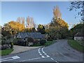
Lane at Eldersfield
Two roads join up east of the churchyard at St. John the Baptist parish church.
Image: © Fabian Musto
Taken: 4 Nov 2021
0.12 miles
10
Path at St. John the Baptist church (Eldersfield)
The path leading to St. John the Baptist parish church offers a nice view of the southernmost village in the county of Worcestershire, and that is Eldersfield.
Image: © Fabian Musto
Taken: 4 Nov 2021
0.12 miles