
IMAGES TAKEN NEAR TO
The Village, DYMOCK, GL18 2AH
Introduction
This page details the photographs taken nearby to The Village, GL18 2AH by members of the Geograph project.
The Geograph project started in 2005 with the aim of publishing, organising and preserving representative images for every square kilometre of Great Britain, Ireland and the Isle of Man.

There are currently over 7.5m images from over14,400 individuals and you can help contribute to the project by visiting https://www.geograph.org.uk
Image Map
Images are licensed for reuse under creativecommons.org/licenses/by-sa/2.0
Notes
- Clicking on the map will re-center to the selected point.
- The higher the marker number, the further away the image location is from the centre of the postcode.
Image Listing (304 Images Found)
Images are licensed for reuse under creativecommons.org/licenses/by-sa/2.0
Image
Details
Distance
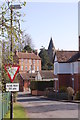
2
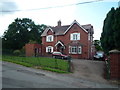
Former Police Station (Dymock)
Built in 1898 according to the inscription on top of the building, it also mentions the use this building used to house as a police station for a while until turning into a private house. Nearby to this building is the old railway station and railway line.
Image: © Fabian Musto
Taken: 7 Aug 2019
0.01 miles
3
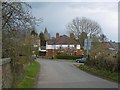
Kempley Road, Dymock
The railway station was situated on the right.
Image: © Richard Webb
Taken: 14 Apr 2016
0.02 miles
4
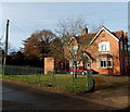
Late Victorian former police station in Dymock
Viewed from the corner of Western Way. An inscription above the upper right window shows
POLICE STATION 1898.
Image: © Jaggery
Taken: 8 Dec 2013
0.02 miles
5
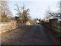
Former railway bridge in Dymock
The stone bridge carries Crown Close over the railbed of the dismantled former
Gloucester to Ledbury branch line near the site of demolished Dymock railway station.
Image: © Jaggery
Taken: 8 Dec 2013
0.02 miles
6
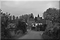
Dymock from the old railway bridge
The stumpy spire of St Mary's church, which is Norman in origin, is visible between the houses. Dymock is home to the Dymock Red cider apple and Stinking Bishop cheese, or so I've just read on Wikipedia.
Image: © John Winder
Taken: 31 Oct 2016
0.03 miles
7
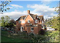
Former Police Station and House, Dymock
Dated 1898 and next to the former railway station. Dymock is a very attractive village and an extremely lively community, but like so many villages it is full of 'former' facilities - pubs, shops, railway, canal, school, etc. Dymock is forever famous for its links with early 20th century poetry.
Image: © Philip Pankhurst
Taken: 12 Oct 2011
0.03 miles
9
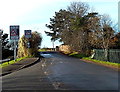
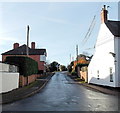
Signs on a corner in Dymock
On the corner of Western Way and Crown Close. When the lights are flashing on the sign nearer the camera, the speed limit is 20mph because schoolchildren are likely to be nearby. The other sign shows that there is no footway alongside Crown Close for 50 yards ahead.
Image: © Jaggery
Taken: 8 Dec 2013
0.03 miles
10
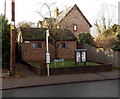
Dymock public toilets
The brick building is on the corner of the B4215 and Crown Close.
Image: © Jaggery
Taken: 8 Dec 2013
0.03 miles