1
Cottages, Culver Street, Newent
Culver Street takes traffic out of Newent to the south and forms part of the B4216. As the road travels south, away from the market town, the houses become more modern.
Image: © Pauline E
Taken: 1 Feb 2008
0.03 miles
2
Richardson's Budgens, Newent
Supermarket set back from the south side of Market Square in Newent town centre.
A banner above the entrance shows that a fresh fish van is here every Wednesday from 8am-2pm.
Update December 2015. Now a Co-operative Foodstore. http://www.geograph.org.uk/photo/4777899
Image: © Jaggery
Taken: 13 Nov 2011
0.03 miles
3
Co-operative Food Store, Newent
Set back from Bury Bar Lane, viewed in late December 2015.
Richardson's Budgens supermarket http://www.geograph.org.uk/photo/3229573 was here in November 2011.
Image: © Jaggery
Taken: 28 Dec 2015
0.03 miles
4
From Foley Road towards Freeman's Orchard, Newent
Houses in view are 224-219 Foley Road.
Image: © Jaggery
Taken: 28 Dec 2015
0.03 miles
5
Cherry Orchard Cottage, Culver Street, Newent
Grade II listed timbered-framed building dating from the 17th century with later alterations.
Image: © Jaggery
Taken: 28 Dec 2015
0.04 miles
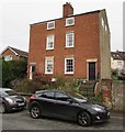
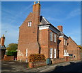
6
Three-storey brick semis, Culver Street, Newent
Three (or perhaps two and a half) storey semi-detached houses on the east side of Culver Street.
Image: © Jaggery
Taken: 28 Dec 2015
0.04 miles
7
Richardson's Budgen store, Newent
Supermarket in the centre of this small Gloucestershire town.
Image: © Jonathan Billinger
Taken: 3 May 2010
0.04 miles
8
Pink timbered-framed house, Newent
This Culver Street house was built as two houses in the 17th century.
The front wall of the house is timber-framed.
Image: © Jaggery
Taken: 13 Nov 2011
0.04 miles
9
The Tan House, Newent
Now divided into flats, The Tan House, 33 Culver Street, was built in the late 17th century. The year 1695 is shown in a roundel on the adjacent building http://www.geograph.org.uk/photo/3103074 presumably part of the former tannery.
Image: © Jaggery
Taken: 13 Nov 2011
0.04 miles
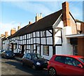
10
Row of 5 black and white timber-framed houses, Newent
Numbers 62-70 (even numbers) Culver Street date from the 17th century. The irregularities in the nominally horizontal and vertical beams are typical of timber-framed houses of this age.
Image: © Jaggery
Taken: 13 Nov 2011
0.05 miles


