
IMAGES TAKEN NEAR TO
Akermans Orchard, NEWENT, GL18 1QD
Introduction
This page details the photographs taken nearby to Akermans Orchard, GL18 1QD by members of the Geograph project.
The Geograph project started in 2005 with the aim of publishing, organising and preserving representative images for every square kilometre of Great Britain, Ireland and the Isle of Man.

There are currently over 7.5m images from over14,400 individuals and you can help contribute to the project by visiting https://www.geograph.org.uk
Image Map
Images are licensed for reuse under creativecommons.org/licenses/by-sa/2.0
Notes
- Clicking on the map will re-center to the selected point.
- The higher the marker number, the further away the image location is from the centre of the postcode.
Image Listing (49 Images Found)
Images are licensed for reuse under creativecommons.org/licenses/by-sa/2.0
Image
Details
Distance
1
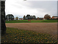
Playing fields, Newent
With rugby pitch, football pitch, children's playground and a toilet block.
Image: © Pauline E
Taken: 5 Nov 2007
0.03 miles
2
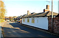
Early Victorian house, Watery Lane, Newent
This long single-storey detached house was built in 1850. Its two-storey semi-detached neighbours were built more than a century later.
Image: © Jaggery
Taken: 13 Nov 2011
0.03 miles
3
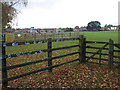
Children's playground in the playing field, Newent
Image: © Pauline E
Taken: 5 Nov 2007
0.03 miles
4
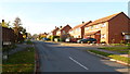
The Tythings, Newent
Residential street viewed from the Watery Lane end.
Image: © Jaggery
Taken: 13 Nov 2011
0.11 miles
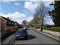
6

Newent Community School, 1
Main block photographed during the summer holidays, 2021.
Image: © Jonathan Billinger
Taken: 5 Aug 2021
0.12 miles
7
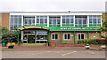
Newent Community School, 2
Main block photographed during the summer holidays, 2021.
Image: © Jonathan Billinger
Taken: 5 Aug 2021
0.12 miles
8
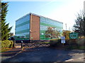
Northern corner of Newent Community School
Viewed from Watery Lane.
Newent Community School and Sixth Form Centre was Gloucestershire’s first purpose-built comprehensive school. It opened in April 1965. Nearly half a century later, it is now a Foundation School serving the town of Newent and the surrounding rural community. There are about 1300 students enrolled.
Image: © Jaggery
Taken: 13 Nov 2011
0.13 miles
9
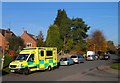
Emergency ambulance, Watery Lane, Newent
Viewed from the entrance to Newent Community School. http://www.geograph.org.uk/photo/2693734
The ambulance is part of the Great Western Ambulance Service (GWAS), a National Health Service Trust. GWAS provides accident & emergency (999) and urgent care; patient transport service; out-of-hours service (in Gloucestershire). The areas covered are: Bath and North East Somerset; Bristol; Gloucestershire; Wiltshire; North Somerset; Swindon (including Watchfield and Shrivenham).
Image: © Jaggery
Taken: 13 Nov 2011
0.13 miles
10
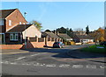
Johnstone Road, Newent
The northern end of Johnstone Road view across Watery Lane.
Image: © Jaggery
Taken: 13 Nov 2011
0.17 miles