
IMAGES TAKEN NEAR TO
Johnstone Road, NEWENT, GL18 1PZ
Introduction
This page details the photographs taken nearby to Johnstone Road, GL18 1PZ by members of the Geograph project.
The Geograph project started in 2005 with the aim of publishing, organising and preserving representative images for every square kilometre of Great Britain, Ireland and the Isle of Man.

There are currently over 7.5m images from over14,400 individuals and you can help contribute to the project by visiting https://www.geograph.org.uk
Image Map
Images are licensed for reuse under creativecommons.org/licenses/by-sa/2.0
Notes
- Clicking on the map will re-center to the selected point.
- The higher the marker number, the further away the image location is from the centre of the postcode.
Image Listing (315 Images Found)
Images are licensed for reuse under creativecommons.org/licenses/by-sa/2.0
Image
Details
Distance
1
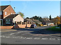
Johnstone Road, Newent
The northern end of Johnstone Road view across Watery Lane.
Image: © Jaggery
Taken: 13 Nov 2011
0.02 miles
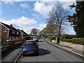
3
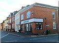
Barclays Bank, Newent
Town centre bank branch on the corner of Broad Street and Culver Street.
Behind Barclays is a branch of Lloyds TSB
Image: © Jaggery
Taken: 13 Nov 2011
0.07 miles
4
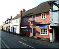
Buttery Tea Rooms, Newent
Located at 1 Culver Street, near the Broad Street junction. The business provides breakfast and morning teas and coffees, lunches, and light snacks throughout the day. Also available are cream teas and old fashioned afternoon tea with sandwiches and cakes.
Image: © Jaggery
Taken: 13 Nov 2011
0.07 miles
5
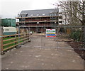
Frontier Invest & Build construction site, Newent
Set back from the west side of Culver Street, viewed in late December 2015.
Image: © Jaggery
Taken: 28 Dec 2015
0.08 miles
6
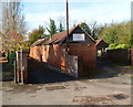
Markey Blacksmiths, Newent
Premises at 25 Culver Street of G.I.Markey & Son, established 1927.
Image: © Jaggery
Taken: 13 Nov 2011
0.09 miles
7
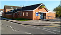
Former police station, Newent
A Freehold for Sale sign is on this Watery Lane building which was Newent police station until closure on June 15th 2011. A notice on the building states that driving documents can be presented at Gloucester Bearlands or Coleford police station. For other police matters, the Gloucestershire Constabulary website states that the nearest open police station is in Cinderford.
Image: © Jaggery
Taken: 13 Nov 2011
0.09 miles
8
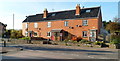
Holts Terrace, Newent
A row of four houses on the corner of Holts Road and Watery Lane.
Viewed from near the former Newent police station. http://www.geograph.org.uk/photo/2693171
Image: © Jaggery
Taken: 13 Nov 2011
0.09 miles
9
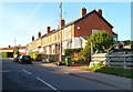
Holts Road, Newent
Viewed from the Watery Lane end. There are houses only on this side of the street along most of Holts Road. There are allotments on the other side.
Image: © Jaggery
Taken: 13 Nov 2011
0.09 miles
10
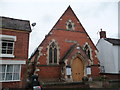
Wesley Chapel, Newent
A fine town centre Victorian chapel.
Image: © Jeremy Bolwell
Taken: 27 Aug 2012
0.09 miles