
IMAGES TAKEN NEAR TO
Stowfield, LYDBROOK, GL17 9NF
Introduction
This page details the photographs taken nearby to Stowfield, GL17 9NF by members of the Geograph project.
The Geograph project started in 2005 with the aim of publishing, organising and preserving representative images for every square kilometre of Great Britain, Ireland and the Isle of Man.

There are currently over 7.5m images from over14,400 individuals and you can help contribute to the project by visiting https://www.geograph.org.uk
Image Map
Images are licensed for reuse under creativecommons.org/licenses/by-sa/2.0
Notes
- Clicking on the map will re-center to the selected point.
- The higher the marker number, the further away the image location is from the centre of the postcode.
Image Listing (117 Images Found)
Images are licensed for reuse under creativecommons.org/licenses/by-sa/2.0
Image
Details
Distance
1

Stowfield Cottages
As seen from the footpath by Stowfield Farm.
Image: © Stuart Wilding
Taken: 19 Apr 2007
0.00 miles
2
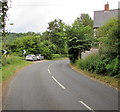
Bend in the road, Stowfield
Bend in the unclassified road from English Bicknor to Lower Lydbrook, near Tumps Hill.
Image: © Jaggery
Taken: 31 Jul 2016
0.01 miles
3

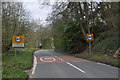
Roadside mirror, Stowfield
Facing northbound traffic on the road from English Bicknor to Lower
Lydbrook in Gloucestershire, the mirror is opposite a side road junction.
Image: © Jaggery
Taken: 31 Jul 2016
0.03 miles
5
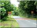
Stowfield City Limits
Approaching this riverside industrial hamlet from the Coleford direction.
Image: © Jonathan Billinger
Taken: 3 Aug 2009
0.04 miles
6
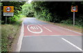
Stowfield - Please drive carefully
The National Speed Limit on the unclassified road from English Bicknor drops to 40mph in Stowfield,
a hamlet in the civil parish of Lydbrook in the Forest of Dean local government district in Gloucestershire.
Image: © Jaggery
Taken: 31 Jul 2016
0.05 miles
7
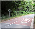
End of the 40 zone beyond Stowfield
The 40mph speed limit through Stowfield, a hamlet near Lower Lydbrook,
increases to the National Speed Limit on the unclassified road to English Bicknor.
Image: © Jaggery
Taken: 31 Jul 2016
0.05 miles
8
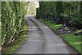
Entrance to Stowfield Farm
Start of the path that leads to English Bicknor. Though the path continues on behind the photographer.
Image: © Stuart Wilding
Taken: 11 Apr 2014
0.06 miles
9
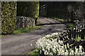
By Stowfield Farm
This road is part of the path that leads to English Bicknor.
Image: © Stuart Wilding
Taken: 11 Apr 2014
0.06 miles
10

Access road to Stowfield Farm, Stowfield
Descending from the unclassified road from Lower Lydbrook to English Bicknor.
Image: © Jaggery
Taken: 31 Jul 2016
0.07 miles