1
View of part of Drybrook
Image: © Des Blenkinsopp
Taken: 6 Feb 2015
0.06 miles
2
Flag at Drybrook Church
Looking down from Holy Trinity churchyard past the war memorial onto the A4136.
Image: © Des Blenkinsopp
Taken: 6 Feb 2015
0.06 miles
3
Parking area, Trinity Road, Harrow Hill
This view was taken half an hour before the start of the 11am Sunday service at the nearby Forest Church. http://www.geograph.org.uk/photo/3345980 At 11am this area, set back from the west side of Trinity Road, was full of parked cars.
Image: © Jaggery
Taken: 24 Feb 2013
0.07 miles
4
Hale's builders merchants
The part of the site concerned with building materials and aggregates. The forest is never far away.
Image: © Jonathan Billinger
Taken: 5 Jan 2008
0.07 miles
5
Bridge Road, Harrow Hill
Ex-quarryman's cottages on the steep hill down to the Drybrook valley bottom.
Ruardeanhill Plantation in the distance beyond.
Image: © Jonathan Billinger
Taken: 9 Jun 2009
0.08 miles
6
Forest Church War Memorial enclosure, Drybrook
The War Memorial http://www.geograph.org.uk/photo/3346168 is at the SW tip of the churchyard of the Forest Church (or Holy Trinity Drybrook). Viewed from Trinity Road looking towards the A4136 on the far side of the enclosure.
Image: © Jaggery
Taken: 24 Feb 2013
0.09 miles
7
Forest Church War Memorial, Drybrook
The War Memorial is in an enclosure at the SW tip of the churchyard of the Forest Church, also known as Holy Trinity Drybrook. http://www.geograph.org.uk/photo/3345980 The location is at the junction of Trinity Road and the A4136.
Image: © Jaggery
Taken: 24 Feb 2013
0.09 miles
8
Trinity Road
On its way to join the A4136.
Image: © Pauline E
Taken: 14 Sep 2007
0.09 miles
9
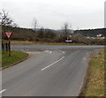
A4136 road junction near Nailbridge
Viewed along Trinity Road looking towards the A4136. Turn left for Gloucester, right for Monmouth (and Nailbridge).
Image: © Jaggery
Taken: 24 Feb 2013
0.09 miles
10
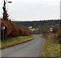
Trinity Road, Harrow Hill
Trinity Road descends from the Forest Church http://www.geograph.org.uk/photo/3346122 towards the A4136 junction.
Image: © Jaggery
Taken: 24 Feb 2013
0.09 miles


