
IMAGES TAKEN NEAR TO
Drybrook Road, DRYBROOK, GL17 9JF
Introduction
This page details the photographs taken nearby to Drybrook Road, GL17 9JF by members of the Geograph project.
The Geograph project started in 2005 with the aim of publishing, organising and preserving representative images for every square kilometre of Great Britain, Ireland and the Isle of Man.

There are currently over 7.5m images from over14,400 individuals and you can help contribute to the project by visiting https://www.geograph.org.uk
Image Map
Images are licensed for reuse under creativecommons.org/licenses/by-sa/2.0
Notes
- Clicking on the map will re-center to the selected point.
- The higher the marker number, the further away the image location is from the centre of the postcode.
Image Listing (90 Images Found)
Images are licensed for reuse under creativecommons.org/licenses/by-sa/2.0
Image
Details
Distance
1

Gloucester bus in Drybrook Road, Drybrook
Stagecoach bus number 25234 on route 24A to Gloucester via Mitcheldean passes the Quabbs Road junction.
Image: © Jaggery
Taken: 11 Dec 2016
0.01 miles
2

Drybrook Telephone Exchange
Situated in Drybrook Road, this redbrick TE is of a standard design dating from the early 1970s, and has the code SSDBK. It provides telephone and broadband services to 2,735 residential and 191 non-residential premises in Drybrook plus Mitcheldean, Nailbridge, Ruardean and Ruardean Woodside nearby. Two rubbish containers can be seen in front of this TE, whilst a BT Openreach van is parked to the right of the photo. The numbering range of this TE is (01594) 54xxxx, the (01594) referring to the Lydney group of nine TEs, and its postcode is GL17 9JG.
Image: © David Hillas
Taken: 6 Sep 2017
0.02 miles
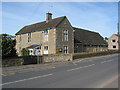
4
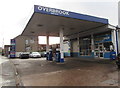
Overbrook Services, Drybrook
Garage, filling station and small shop alongside Drybrook Road.
Overbrook Services is on top of a culverted part of Dry Brook. http://www.geograph.org.uk/photo/5222250
Image: © Jaggery
Taken: 11 Dec 2016
0.03 miles
5
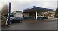
Overbrook Services, Drybrook
Garage, filling station and small shop alongside Drybrook Road.
Overbrook Services is on top of a culverted part of Dry Brook. http://www.geograph.org.uk/photo/5222250
Image: © Jaggery
Taken: 11 Dec 2016
0.03 miles

7
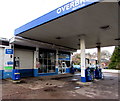
Omitec Diagnostic Centre, Overbrook Services, Drybrook
Omitec Diagnostic Centre on the left is part of this http://www.geograph.org.uk/photo/5224246 garage, filling station and small shop site alongside Drybrook Road.
Image: © Jaggery
Taken: 11 Dec 2016
0.04 miles
8
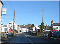
Drybrook Road
Looking north near the Hearts of Oak pub.
Image: © Pauline E
Taken: 18 Jan 2009
0.04 miles
9
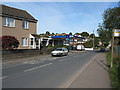
Petrol Station, Drybrook Road
99.9 pence a litre.
Image: © Pauline E
Taken: 18 Oct 2007
0.04 miles
10
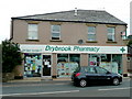
Drybrook Pharmacy
Situated on the main street, opposite Drybrook Garage Image
Image: © Jonathan Billinger
Taken: 9 Jun 2009
0.04 miles