IMAGES TAKEN NEAR TO
Hillside Road, DRYBROOK, GL17 9HN
Introduction
This page details the photographs taken nearby to Hillside Road, GL17 9HN by members of the Geograph project.
The Geograph project started in 2005 with the aim of publishing, organising and preserving representative images for every square kilometre of Great Britain, Ireland and the Isle of Man.

There are currently over 7.5m images from over14,400 individuals and you can help contribute to the project by visiting https://www.geograph.org.uk
Image Map (Loading...)


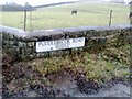
Getting Data...Please wait
Leaflet Map data © OpenStreetMap
Images are licensed for reuse under creativecommons.org/licenses/by-sa/2.0
Notes
- Clicking on the map will re-center to the selected point.
- The higher the marker number, the further away the image location is from the centre of the postcode.
Image Listing (22 Images Found)
Images are licensed for reuse under creativecommons.org/licenses/by-sa/2.0
Image
Details
Distance
2
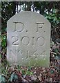
Boundary Stone, Drybrook
Modern Forest of Dean boundary stone on Gloucestershire footpath DDB5, just off Hawthorns Road, opposite "Stonecroft".
Inscription: D. F. / 2010 / Nᴼ. 144
Milestone Society National ID: GL_DFDRYB144em
Image: © Mr Red
Taken: 4 Feb 2023
0.12 miles
3
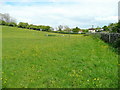
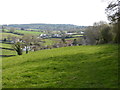
Pasture by Puddlebrook Road
Looking east towards Mitcheldean Meend.
Image: © Jonathan Billinger
Taken: 21 May 2009
0.13 miles
4
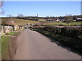
Puddlebrook Road
Leading to Wigpool Common.
Image: © Pauline E
Taken: 30 Oct 2007
0.13 miles
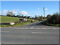
5
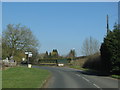
Towards Road Junction, Drybrook
Looking East.
Image: © Stuart Wilding
Taken: 9 Feb 2006
0.14 miles
6

Boundary Stone, Hawthorn Road, Drybrook
Old Forest of Dean boundary stone, on the property of the former Crown Inn.
Inscription: D. F. / 1832 / Nᴼ. 145
Milestone Society National ID: GL_DFDRYB145em
Image: © Mr Red
Taken: 4 Feb 2023
0.14 miles
7
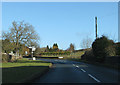
Hawthorns Road
Approaching the crossroads before The Cutting, north of Drybrook.
Image: © Pauline E
Taken: 18 Jan 2009
0.14 miles
10
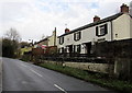
Houses near the northern edge of Drybrook
On the east side of Hawthorn Road.
Image: © Jaggery
Taken: 11 Dec 2016
0.16 miles