
IMAGES TAKEN NEAR TO
Hazel Road, DRYBROOK, GL17 9HF
Introduction
This page details the photographs taken nearby to Hazel Road, GL17 9HF by members of the Geograph project.
The Geograph project started in 2005 with the aim of publishing, organising and preserving representative images for every square kilometre of Great Britain, Ireland and the Isle of Man.

There are currently over 7.5m images from over14,400 individuals and you can help contribute to the project by visiting https://www.geograph.org.uk
Image Map
Images are licensed for reuse under creativecommons.org/licenses/by-sa/2.0
Notes
- Clicking on the map will re-center to the selected point.
- The higher the marker number, the further away the image location is from the centre of the postcode.
Image Listing (77 Images Found)
Images are licensed for reuse under creativecommons.org/licenses/by-sa/2.0
Image
Details
Distance
1
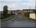
West Avenue, Drybrook
From High Street, West Avenue leads to Sunnymeade Estate.
Image: © Jaggery
Taken: 11 Dec 2016
0.06 miles
2
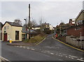
Hillside Road, Drybrook
Ascending from Hawthorn Road towards Puddlebrook, about 700 metres ahead.
Image: © Jaggery
Taken: 11 Dec 2016
0.09 miles
3
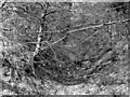
Track of the GWR branch from Newnham and Cinderford to Drybrook and Mitcheldean Road, 1954
The view is roughly NW, just north of Drybrook off the road to Puddlebrook, of the track, just south of Euroclydon Tunnel, of the mineral extension of the GWR branch from Cinderford to Drybrook, to Mitcheldean Road (on the Ross-on-Wye - Hereford line). A passenger service ran from Cinderford to Drybrook Halt until July 1936, but part of the stretch north from Drybrook may not have been used at all, part having been taken up in February 1917 - only 10 years after it was laid. The precise location of this photograph - of 'just trees' - is a little bit uncertain but relates to a railway seldom recorded.
Image: © Ben Brooksbank
Taken: 1 May 1954
0.10 miles
4
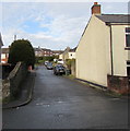
Manse Road, Drybrook
From High Street along Manse Road towards Hazel Road.
Image: © Jaggery
Taken: 11 Dec 2016
0.11 miles
5
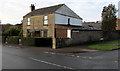
Corner house in Drybrook
On the corner of High Street (on the left) and West Avenue.
Image: © Jaggery
Taken: 11 Dec 2016
0.11 miles
6
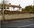
High Street wall and notice, Drybrook
A dog fouling penalty notice http://www.geograph.org.uk/photo/5236210 is on the pole on the left.
Image: © Jaggery
Taken: 11 Dec 2016
0.11 miles
7
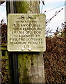
Dog fouling penalty notice, High Street, Drybrook
Located on the left here. http://www.geograph.org.uk/photo/5236214
Both the condition of the notice and the stated maximum penalty of only
£20 suggest that this is an obsolete Forest of Dean District Council notice.
Image: © Jaggery
Taken: 11 Dec 2016
0.11 miles
8
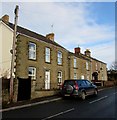
Houses in Drybrook
Viewed across High Street.
Image: © Jaggery
Taken: 11 Dec 2016
0.11 miles
9
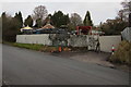
Coalyard in Drybrook
Viewed across Hawthorn Road. The A W Parker yard is on the NW side of the business's shop and office. http://www.geograph.org.uk/photo/5225859
Image: © Jaggery
Taken: 11 Dec 2016
0.11 miles
10
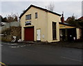
A W Parker Coal Merchants, Drybrook
The coal merchants' office is alongside Hawthorn Road near the corner of Hillside Road.
The coalyard http://www.geograph.org.uk/photo/5225892 is out of shot on the left.
Image: © Jaggery
Taken: 11 Dec 2016
0.11 miles