
IMAGES TAKEN NEAR TO
Hazel Hill, DRYBROOK, GL17 9EJ
Introduction
This page details the photographs taken nearby to Hazel Hill, GL17 9EJ by members of the Geograph project.
The Geograph project started in 2005 with the aim of publishing, organising and preserving representative images for every square kilometre of Great Britain, Ireland and the Isle of Man.

There are currently over 7.5m images from over14,400 individuals and you can help contribute to the project by visiting https://www.geograph.org.uk
Image Map
Images are licensed for reuse under creativecommons.org/licenses/by-sa/2.0
Notes
- Clicking on the map will re-center to the selected point.
- The higher the marker number, the further away the image location is from the centre of the postcode.
Image Listing (102 Images Found)
Images are licensed for reuse under creativecommons.org/licenses/by-sa/2.0
Image
Details
Distance
1
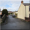
Manse Road, Drybrook
From High Street along Manse Road towards Hazel Road.
Image: © Jaggery
Taken: 11 Dec 2016
0.03 miles
2
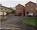
Two modern houses above Hawthorn Road, Drybrook
The houses have their garage built into the house, alongside the front door.
The name on the 3-storey house on the left is The Tall House,
a name which would also apply to its apparently unnamed neighbour on the right.
Image: © Jaggery
Taken: 11 Dec 2016
0.04 miles
3
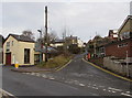
Hillside Road, Drybrook
Ascending from Hawthorn Road towards Puddlebrook, about 700 metres ahead.
Image: © Jaggery
Taken: 11 Dec 2016
0.04 miles
4
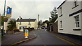
Hawthorns Road, Drybrook
The effect of the traffic calming has benefited this part of Drybrook even if some folks ignore the priority signage.
Image: © Jonathan Billinger
Taken: 27 Mar 2018
0.05 miles
5
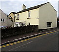
Chapel House, Hawthorn Road, Drybrook
A stone wall ends at the edge of Chapel House.
Image: © Jaggery
Taken: 11 Dec 2016
0.06 miles
6
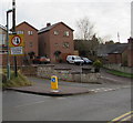
Give way to oncoming vehicles, Hawthorn Road, Drybrook
For about 2 metres at the Hillside Road junction, the width of Hawthorn Road is reduced to one lane.
Image: © Jaggery
Taken: 11 Dec 2016
0.06 miles
7
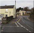
Two Hawthorn Road junctions, Drybrook
The Back Lane junction is on the left.
The Hillside Road junction is 50 metres ahead on the right.
Image: © Jaggery
Taken: 11 Dec 2016
0.06 miles
8
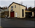
A W Parker Coal Merchants, Drybrook
The coal merchants' office is alongside Hawthorn Road near the corner of Hillside Road.
The coalyard http://www.geograph.org.uk/photo/5225892 is out of shot on the left.
Image: © Jaggery
Taken: 11 Dec 2016
0.06 miles
9
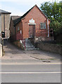
Meeting Room of Drybrook & District Male Voice Choir
Hawthorns Road, Drybrook.
Maybe it's a small choir?
The Methodist Church is behind this building.
Image: © Pauline E
Taken: 18 Oct 2007
0.06 miles
10

Visibility mirror on a Drybrook corner
On the corner of Hawthorn Road and Back Lane.
Image: © Jaggery
Taken: 11 Dec 2016
0.06 miles