1
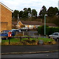
Two telecoms cabinets, High Street, Drybrook
Viewed in December 2016. The Openreach notice on the cabinet on the left states
You are now in Fastershire - fibre broadband is here.
Only the cabinet on the right is in a September 2009 Google Earth Street View.
Image: © Jaggery
Taken: 11 Dec 2016
0.05 miles
2
Former Drybrook Police Station
Viewed across High Street in 2016. A tablet on the wall of the white house shows
GLOUCESTERSHIRE POLICE STATION.
Image: © Jaggery
Taken: 11 Dec 2016
0.05 miles
3
Queen Elizabeth II postbox, High Street, Drybrook
Near the corner of Mannings Road.
Image: © Jaggery
Taken: 11 Dec 2016
0.07 miles
4
High Street bus stop and shelter, Drybrook
On the corner of Mannings Road.
Image: © Jaggery
Taken: 11 Dec 2016
0.08 miles
5
Road and public footpath towards Manning's Farm, Drybrook
A public footpath sign on the corner of High Street points this way.
Image: © Jaggery
Taken: 11 Dec 2016
0.09 miles
6
Public footpath sign on a corner of High Street, Drybrook
The sign points right towards this http://www.geograph.org.uk/photo/5236366 road and public footpath towards Manning's Farm.
Image: © Jaggery
Taken: 11 Dec 2016
0.09 miles
7
High Street bus stop, Drybrook
Near the corner of West Avenue.
Image: © Jaggery
Taken: 11 Dec 2016
0.10 miles
8
The clubhouse, Drybrook RFC
Founded 1892 and with lots of teams including a girls' team.
Image: © Pauline E
Taken: 23 Feb 2008
0.10 miles
9
Mannings Road, Drybrook
The southern end of Mannings Road viewed from High Street.
Image: © Jaggery
Taken: 11 Dec 2016
0.10 miles
10
Corner house in Drybrook
On the corner of High Street (on the left) and West Avenue.
Image: © Jaggery
Taken: 11 Dec 2016
0.10 miles


