
IMAGES TAKEN NEAR TO
Sterrys Lane, LONGHOPE, GL17 0NF
Introduction
This page details the photographs taken nearby to Sterrys Lane, GL17 0NF by members of the Geograph project.
The Geograph project started in 2005 with the aim of publishing, organising and preserving representative images for every square kilometre of Great Britain, Ireland and the Isle of Man.

There are currently over 7.5m images from over14,400 individuals and you can help contribute to the project by visiting https://www.geograph.org.uk
Image Map
Images are licensed for reuse under creativecommons.org/licenses/by-sa/2.0
Notes
- Clicking on the map will re-center to the selected point.
- The higher the marker number, the further away the image location is from the centre of the postcode.
Image Listing (48 Images Found)
Images are licensed for reuse under creativecommons.org/licenses/by-sa/2.0
Image
Details
Distance
1

Dream cottage in autumn
The same view (almost) as in Image nearly seven months on.
Image: © Jonathan Billinger
Taken: 30 Oct 2011
0.03 miles
2

Dream cottage
This place is a feature of my daily commute to Gloucester. View to the north of the A40 on a light spring evening.
Image: © Jonathan Billinger
Taken: 2 Apr 2011
0.04 miles
3

Steep lane at Dursley Cross
Looking downhill. There is a maze of tiny lanes linking scattered cottages and farms here on the south-east slopes of May Hill.
Image: © Jonathan Billinger
Taken: 2 Sep 2009
0.09 miles
4

Rough ground by Sterry's Lane
Hillside Brewery can be seen just below the woodland of Huntley Hill.
The gabled house is on the A40.
Image: © Jonathan Billinger
Taken: 11 Nov 2018
0.09 miles
5

Pastoral scene near the A40
Looking south from Dursley Cross, Huntley Hill rising to the right.
Image: © Jonathan Billinger
Taken: 2 Sep 2009
0.10 miles
6
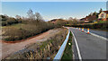
Road repair works, 2
This is advance work for the repair of the collapsing carriage way of the A40 near May Hill.
Looking east towards Gloucester.
Image: © Jonathan Billinger
Taken: 26 Mar 2022
0.11 miles
7
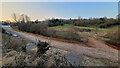
Road repair works, 1
This is advance work for the repair of the collapsing carriageway of the A40 near May Hill.
Image: © Jonathan Billinger
Taken: 25 Mar 2022
0.11 miles
8

Overgrown footpath
This forms an apparently little-used short cut from the A40 down to the May Hill Lane.
Image: © Jonathan Billinger
Taken: 30 Oct 2011
0.13 miles
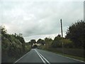
10

Lane junction, May Hill
Left to Dursley Cross, right to Ganders Green and May Hill village hall.
Image: © Jonathan Billinger
Taken: 27 Apr 2020
0.13 miles