
IMAGES TAKEN NEAR TO
Brooklea Gardens, LONGHOPE, GL17 0JY
Introduction
This page details the photographs taken nearby to Brooklea Gardens, GL17 0JY by members of the Geograph project.
The Geograph project started in 2005 with the aim of publishing, organising and preserving representative images for every square kilometre of Great Britain, Ireland and the Isle of Man.

There are currently over 7.5m images from over14,400 individuals and you can help contribute to the project by visiting https://www.geograph.org.uk
Image Map
Images are licensed for reuse under creativecommons.org/licenses/by-sa/2.0
Notes
- Clicking on the map will re-center to the selected point.
- The higher the marker number, the further away the image location is from the centre of the postcode.
Image Listing (55 Images Found)
Images are licensed for reuse under creativecommons.org/licenses/by-sa/2.0
Image
Details
Distance
1
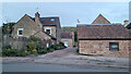
The Old Vicarage, Longhope
The building seems to have its back to the photographer.
Image: © Jonathan Billinger
Taken: 27 Oct 2022
0.06 miles
2
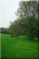
Course of old railway near Longhope
The track of the old Gloucester - Hereford railway line, looking towards Longhope and Gloucester. Taken from the old level crossing pictured at http://www.geograph.org.uk/photo/3941515
Image: © John Winder
Taken: 20 Apr 2014
0.11 miles
3
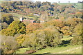
Autumn in Longhope
Autumn in Longhope with the parish church visible among the tree in their autumn colours.
Image: © Philip Halling
Taken: 3 Nov 2012
0.11 miles
4
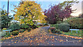
Meadow Rise, Longhope
A short private cul-de-sac.
Image: © Jonathan Billinger
Taken: 20 Oct 2022
0.11 miles
5
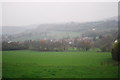
Longhope and its old railway
This shot puts the course of the old railway into geographical context. The railway ran along the low embankment which runs from left to right. Longhope village is behind the railway. Longhope station was out of shot to the left.
Image: © John Winder
Taken: 20 Apr 2014
0.11 miles
7
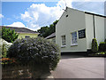
The Old Rectory Residential Care Home
In School Lane.
Image: © Pauline E
Taken: 15 Jun 2008
0.13 miles
8
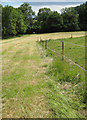
Gloucestershire Way footpath
Heading south through Longhope.
Image: © Pauline E
Taken: 15 Jun 2008
0.13 miles
9
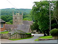
View over All Saints' church, Longhope
Looking east from School Lane; May Hill dominates the background.
Image: © Jonathan Billinger
Taken: 15 Jun 2009
0.14 miles
10
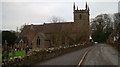
Church in the Forest of Dean
I turned off the A40 and found the church before me. It seemed to deserve to have its picture taken.
Image: © David Robinson
Taken: 23 Dec 2008
0.14 miles