
IMAGES TAKEN NEAR TO
Wigpool, MITCHELDEAN, GL17 0JG
Introduction
This page details the photographs taken nearby to GL17 0JG by members of the Geograph project.
The Geograph project started in 2005 with the aim of publishing, organising and preserving representative images for every square kilometre of Great Britain, Ireland and the Isle of Man.

There are currently over 7.5m images from over14,400 individuals and you can help contribute to the project by visiting https://www.geograph.org.uk
Image Map
Images are licensed for reuse under creativecommons.org/licenses/by-sa/2.0
Notes
- Clicking on the map will re-center to the selected point.
- The higher the marker number, the further away the image location is from the centre of the postcode.
Image Listing (6 Images Found)
Images are licensed for reuse under creativecommons.org/licenses/by-sa/2.0
Image
Details
Distance
1
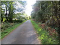
Road near Wigpool Common
Looking south-eastward.
Image: © Peter Wood
Taken: 15 Oct 2016
0.04 miles
2
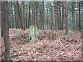
Pingary's Tump, Wigpool Common
This was open land, grazed through commoner's rights. Once there would have been views from this point on the edge of the Forest of Dean scarp, views of use to the Ordnance Survey. Since then the common has been planted.
Pingary, Pingry or Pingery's Tump like a lot of hilltops was used as a site for gallows - in 1723 Eli Hatton, was hanged for the murder of a carpenter, Tom Twibervile. The Mitcheldean Parish Council website also mentions that there was gold mining in the area as well.
Image: © Richard Webb
Taken: 2 Apr 2004
0.06 miles
3
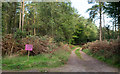
Forest road on Wigpool Common
Wigpool Common is a wooded high point in or just north of the Forest of Dean. According to the rather crudely painted notice, there's just one destination along the road.
Image: © Trevor Littlewood
Taken: 15 Oct 2016
0.07 miles
4
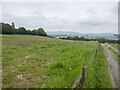
View from Liningwood
Looking north-east towards the dome of May Hill.
Image: © Jonathan Billinger
Taken: 17 Jun 2021
0.11 miles
5
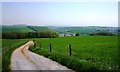
Track towards Mitcheldean from near Pingery Tump
This track soon becomes a footpath across fields and descends to the playing fields in Mitcheldean. Nearby Pingery Tump (aka Pinary Tump) was once the site of a gallows; the last man to be hanged there was Eli Hatton, who had stolen a sheep.
Image: © Clint Mann
Taken: 23 May 2012
0.17 miles
6
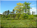
Wigpool Common 3
Scrub, conifers and deciduous trees in the northern end of the Forest of Dean.
Image: © Jonathan Billinger
Taken: 21 May 2009
0.23 miles