
IMAGES TAKEN NEAR TO
Spout Lane, MITCHELDEAN, GL17 0DZ
Introduction
This page details the photographs taken nearby to Spout Lane, GL17 0DZ by members of the Geograph project.
The Geograph project started in 2005 with the aim of publishing, organising and preserving representative images for every square kilometre of Great Britain, Ireland and the Isle of Man.

There are currently over 7.5m images from over14,400 individuals and you can help contribute to the project by visiting https://www.geograph.org.uk
Image Map
Images are licensed for reuse under creativecommons.org/licenses/by-sa/2.0
Notes
- Clicking on the map will re-center to the selected point.
- The higher the marker number, the further away the image location is from the centre of the postcode.
Image Listing (17 Images Found)
Images are licensed for reuse under creativecommons.org/licenses/by-sa/2.0
Image
Details
Distance
1
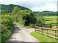
Spout Lane
This lane joins the end of Jubilee Lane at the Edgehill Plantation, the edge of the Forest of Dean, seen in the background.
Image: © Jonathan Billinger
Taken: 25 Aug 2009
0.06 miles
2

Machinery in the woods
Various pieces of equipment litter the woodland at the end of Jubilee Lane.
Image: © Jonathan Billinger
Taken: 3 Mar 2022
0.10 miles
3
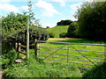
Footpath to Shapridge
Heading east across pasture land from Spout Lane.
Image: © Jonathan Billinger
Taken: 25 Aug 2009
0.13 miles
4
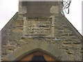
Old School Plump Hill
Wall plaque on the Old School Plump Hill. Now the Plump Hill Environmental Education Centre
Image: © Tony Bailey
Taken: 20 Apr 2006
0.16 miles
5
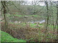
Dipping pond in the Plump Hill Environmental Centre Reserve
Part of the Environmental Centre Reserve, The pond has dipping platforms around its perimeter to allow children easy access when exploring the pondlife in the pool.
Image: © Tony Bailey
Taken: 20 Apr 2006
0.16 miles
7
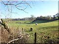
Boundary Stone, Horsepool Bottom
A Forest of Dean boundary stone in a field adjacent to Jubilee Road 1km South of Mitcheldean.
Inscription: D. F / 1832 / Nᴼ. 189
Milestone Society National ID: GL_DFMITC189em
Image: © Mr Red
Taken: 7 Feb 2023
0.18 miles
8
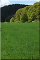
Edgehill Plantations
Shades of green in this view to the Edgehill Plantations from the Gloucestershire Way below Plump Hill.
Image: © Philip Halling
Taken: 15 May 2010
0.19 miles
9
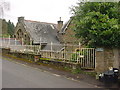
Old School Plump Hill
Now the Plump Hill Environmental Education Centre
Image: © Tony Bailey
Taken: 20 Apr 2006
0.19 miles
10
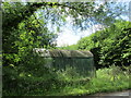
Corrugated iron shed at Shapridge
Image: © Jonathan Thacker
Taken: 15 Jun 2017
0.21 miles